Monk's Trail, Chiang Mai: ride to the trailhead, hike to Wat Pha Lat
The forest path to Wat Pha Lat is Chiang Mai's best short hike, and the trailhead is a 15-minute ride from the Old Town. Where it starts, where to park, what it costs now, and whether to carry on to Doi Suthep.
Tap a numbered stop for details. The route line is indicative — grab an offline map for turn-by-turn.
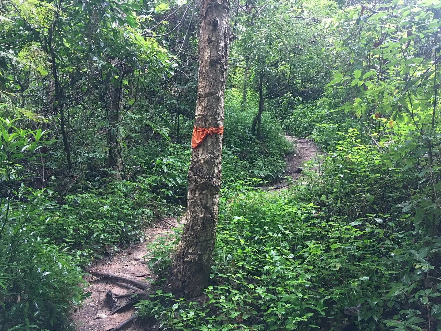
Wat Pha Lat is the quiet temple halfway up Doi Suthep that most people only see from a songthaew window, if at all. The best way in is on foot: the Monk's Trail, a shaded forest path marked with strips of orange cloth tied to the trees, climbs from the back of Chiang Mai University to the temple in about 40 minutes.
The hike is the famous part. The scooter part is what nobody explains properly: the trailhead is 6 km from the Old Town, the last 800 m is a steep lane, and since October 2025 there is a national park booth at the top of it. This is the whole morning, start to finish, with the map.
The route at a glance
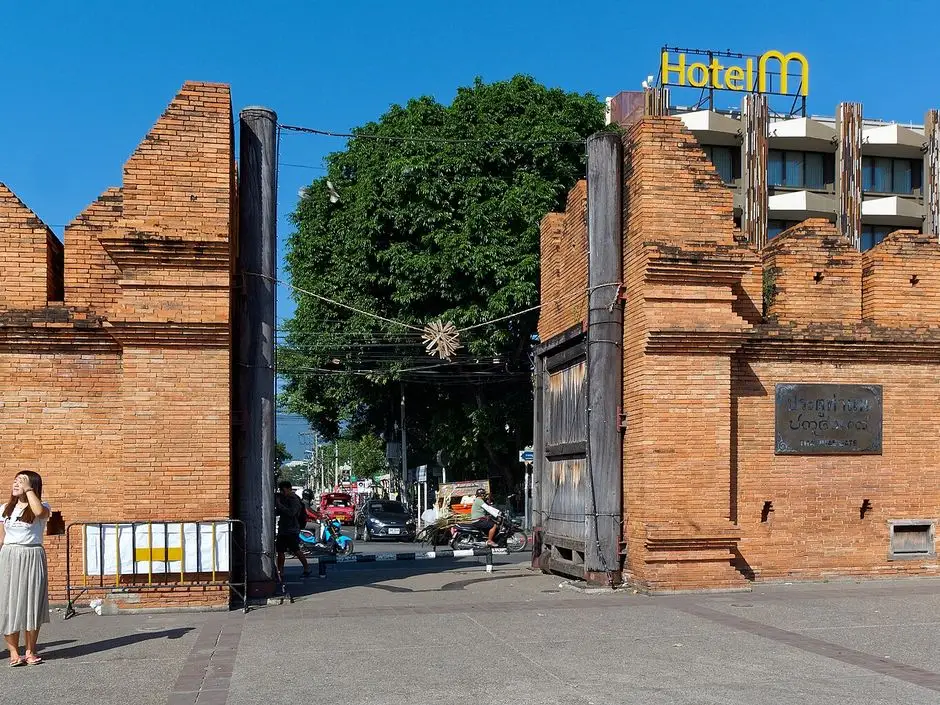
- 1Tha Phae Gate (Old Town) Start. Leave the Old Town on the west side and follow Suthep Road straight out past Wat Suan Dok and the university.
- 2End of Suthep Road Suthep Road ends at a T-junction beside Basecamp Trail Cafe. Turn right, then first left: the lane climbs 800 m to the trail.
- 3Monk's Trail trailhead Where the asphalt ends: the park booth (fee since Oct 2025), a green map board and the first orange cloth on the trees. Park the scooter on the verge here.
- 4Wat Pha Lat On foot: about 1.5 km and 165 m up, 30–50 minutes. The stream, the mossy stone chapel and the view from the rocks. Free.
- 5Wat Phra That Doi Suthep Optional: another 2 km and roughly 450 m up on foot (steep, 60–90 minutes), or ride up Route 1004 afterwards. ฿30 entry for foreigners (2026).
- 6Huay Kaew Waterfall (by the zoo gate) Small cascade at the foot of Route 1004, five minutes from the trailhead. On the park's fee list since Oct 2025, so no longer the free cool-off it used to be.
The morning, leg by leg
Old Town → the trailhead
Out of the moat on the west side, straight along Suthep Road past Wat Suan Dok and the long university fence. At the T-junction by Basecamp Trail Cafe turn right, then first left, and crawl up the 800 m lane to where the asphalt ends. Scooters go on the verge by the booth.
Trailhead → Wat Pha Lat, on foot
Pay at the booth if it is open (฿100 for foreigners), then follow the orange cloth and the banners up through the forest. Keep left at the forks, ignore the steep side trail to Wat Anagami, and you come out at the stream beside the temple. Give the temple 30–60 minutes.
Back down, or on to Doi Suthep
Most people walk back the same way (20–30 minutes) and ride home for a late breakfast. The upper trail to Doi Suthep is a different animal: steep, muddy, barely marked, 60–90 minutes. If you want the big temple too, ride up Route 1004 afterwards instead: 10 km from the trailhead, 25 minutes.
Why do this one
Every list of things to do in Chiang Mai has the Monk's Trail on it, and it survives the attention because it is a real forest path, ten minutes from the university, ending at a temple built as a resting place for people doing exactly what you are doing. Wat Pha Lat went up in 1355, under King Kue Na of Lanna, for pilgrims walking up the mountain to Wat Phra That Doi Suthep. When Kruba Srivichai's volunteers built the road in 1935 the walkers stopped coming and the temple went quiet. It is still quiet. That is the point of it.
The trail itself is short. Searching for it you will find numbers from 1.2 km to 3 km and climbs from 160 m to 350 m; the honest figure from the elevation data is about 1.5 km each way and 165 m of climbing, from the trailhead at about 440 m to the temple at about 610 m. A fit walker is up in 30 minutes, most people take 40–50, and the sign at the start that says 1 hour 30 is being generous. It is steep enough to count as exercise and short enough to be done before breakfast, which is exactly how we would do it.
On a scooter the whole thing fits into a morning: ride out at 06:30, walk up in the cool, have the temple more or less to yourself, and be back in the Old Town for a late breakfast by 10:00.
The road
From the Old Town this is the easiest ride in the guide. Leave the moat on the west side at Suan Dok Gate and go straight along Suthep Road: past Wat Suan Dok, past the hospital, then along the long southern fence of Chiang Mai University. Flat, wide and well lit; busy with students 07:30–09:00 and from 16:00, almost empty at dawn. Helmets on both heads: Suthep Road and Canal Road get regular police checkpoints, and the fine for no helmet is up to ฿2,000 per person.
Suthep Road ends at a T-junction about 3.5 km from the moat, with Basecamp Trail Cafe on the corner. Turn right, ride 250 m, and take the first left. From here a narrow concrete lane climbs about 85 m in 800 m, which is steep for a lane: keep the speed down and do not stop on the steepest bit. The asphalt ends at a small clearing with a wooden gate, a green map board, a booth and, if you look at the trees, the first orange cloth. That is the trailhead. On the way back down, same lane, keep it slow and use the brakes in short squeezes rather than dragging them.
From Nimman it is even closer: Huay Kaew Road to the zoo gate, left onto Canal Road, 1.5 km south to the Basecamp junction, then the lane. Ten minutes.
Fuel: fill up in town; there is nothing after the university. Parking: do what the locals do and leave the scooter on the verge at the top of the lane, next to the booth. Lock the helmets in the under-seat space, take the key. Nobody watches the bikes; it is a forest clearing, not a hotel car park, so leave nothing on the seat.
The booth, and what it costs now
This is the bit the older blogs get wrong. Until 2025 the Monk's Trail was free. On 1 October 2025 Doi Suthep–Pui National Park put the Pha Lat Nature Trail into its fee zone, along with Huay Kaew Waterfall and Doi Pui (the Citylife report has the list). The rates are ฿100 for foreign adults, ฿50 for foreign children, ฿20 and ฿10 for Thais, cash, at the booth at the trailhead. The board also lists ฿20 for a motorcycle and ฿30 for a car. Keep the ticket.
The booth is staffed roughly 08:30 to 16:30. The trail does not close, and if you start at 07:00 there is usually nobody there, but you may be asked to pay on the way down. Wat Pha Lat itself has never charged anything, and if you arrive at either temple by the main road there is nothing to pay at all. The fee is for the path, not the temple.
The hike, stop by stop
1. Tha Phae Gate
The map starts at the Old Town's front door; start wherever you are staying. West to Wat Phra Singh, out through Suan Dok Gate, and Suthep Road does the rest.
2. The end of Suthep Road
The T-junction by Basecamp Trail Cafe is the only navigation to get right: right, 250 m, first left, up. Do not let the map app take you to "Wat Pha Lat": the temple's road entrance is on Route 1004 far above you, and you would ride the mountain road instead of walking the trail. Navigate to the trailhead pin on the map above.
3. The trailhead
Through the wooden gate and past the map board the path starts climbing immediately: dirt, roots and uneven rock steps, shaded nearly the whole way, with the stream close by for the first third. The orange strips of monks' robes are tied to trunks every 30 m or so, with the odd painted arrow and a few prayer banners; after a storm some junctions are less clear, so when in doubt keep left. About two-thirds of the way up a side trail goes hard right to Wat Anagami, 400 m of dirt stairs and bamboo rails. Most people who do it say it was not worth the extra 30 minutes. Keep left.
The two steep pitches are near the top. Then the trees open, you hear water, and the path comes out beside the stream at the temple.
4. Wat Pha Lat
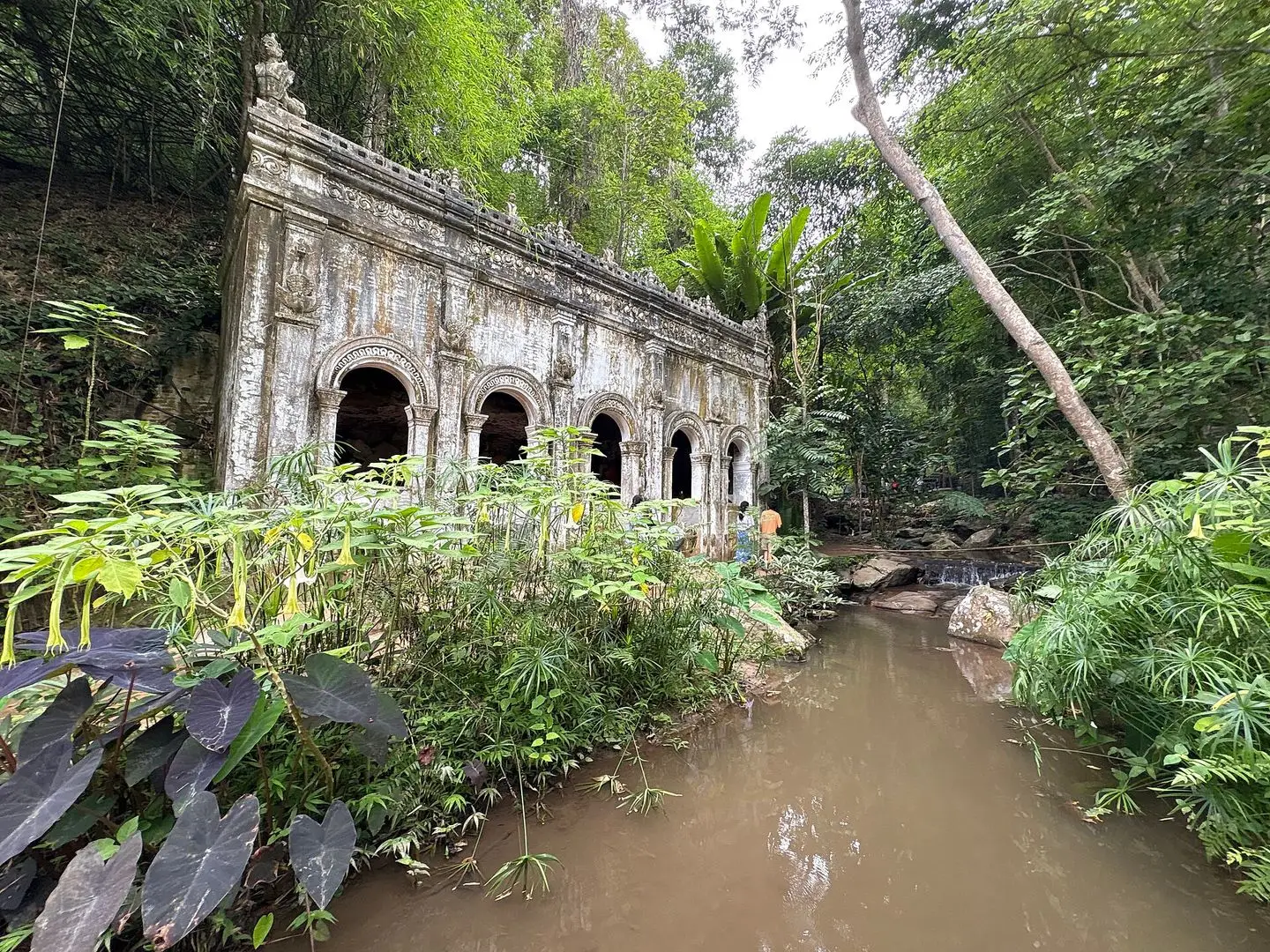
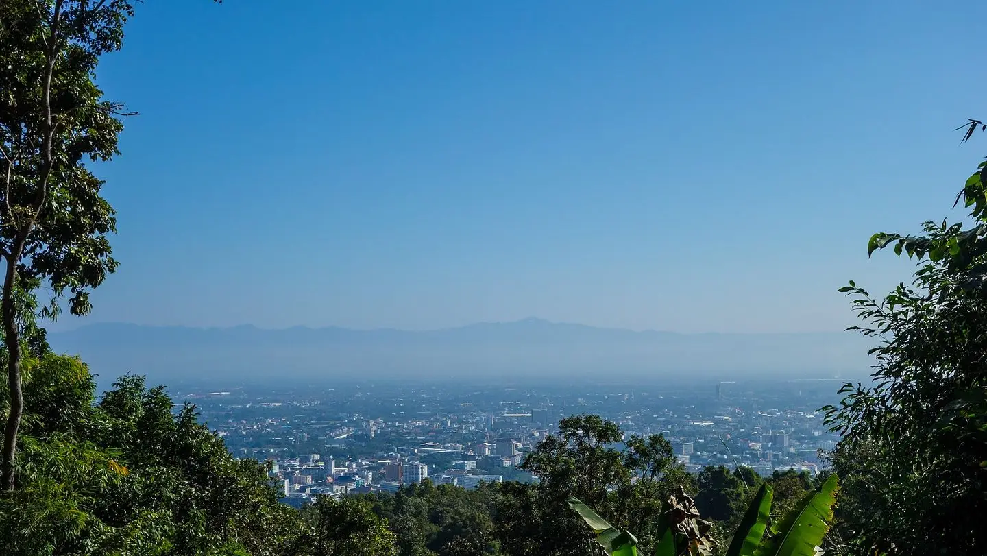
"Pha Lat" means the sloping rock, and the temple is built on and around it: a stream runs through the middle of the grounds, dropping over a few small falls and pooling between boulders, and the buildings are scattered along it under big trees. There is a wooden viharn with a peacock on the gable, a chedi, a white naga staircase coming down beside the water, cave shrines cut into the rock, and the building everyone photographs: a stone chapel with arched windows, its walls slowly going green. Walk out onto the flat rocks beside the stream and on a clear morning the whole of Chiang Mai is laid out below you, which is the moment the climb was for.
It is an active monastery, not a museum: monks live and meditate here, and there are no shops, no ticket desk and no loudspeakers. Shoulders and knees covered, shoes off in the buildings, voices down; the stream is not for swimming or drinking. Give it 30 minutes at least. Toilets at the temple are basic, and there are none on the trail. Opening hours are not posted anywhere we trust, so check Google Maps for today's hours before you set the alarm, and go early: by 10:00 on a weekend the songthaew groups arrive by road and the place is a different temple.
5. On to Doi Suthep (optional, and harder)
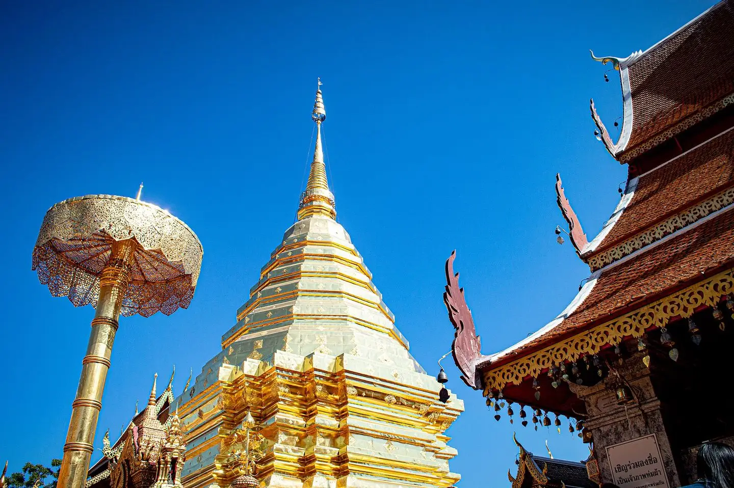
The trail continues to Wat Phra That Doi Suthep, and it is a different proposition. From the temple you walk up to Route 1004, climb over the low barrier, turn left and follow the road uphill for about 100 m; just before it bends left, a gap in the trees on the right takes you back into the forest. From there the path follows the power lines straight up the mountain: about 2 km, roughly 450 m of climbing, steep the whole way, muddy in any month with rain, and with few or no markers. Reckon on 60–90 minutes. It comes out beside the road a few minutes below the temple car park, and then there are the 306 naga steps.
Worth it if you are fit, have shoes with grip and started early; not alone, not after rain, not after 14:00. And your scooter is at the trailhead: from the top you either walk all the way back down (hard on the knees, 60 minutes) or take a songthaew to the zoo for ฿60–100 a head and walk or Grab the last 2 km up the lane to the bike. The temple is ฿30 for foreigners (2026); our Doi Suthep guide covers the top, the funicular and the road.
Our honest suggestion for anyone on a scooter: hike to Wat Pha Lat and back, then ride up Route 1004 to Doi Suthep. It is 10 km from the trailhead, 25 minutes of curves, and you get both temples with your bike where you left it.
6. Huay Kaew Waterfall, on the way home
At the foot of Route 1004, next to the zoo gate and the Kruba Srivichai monument, a stream comes off the mountain in a series of small cascades with pools below them. Locals bring food and sit on the rocks; five minutes from the trailhead, it used to be the obvious free cool-off. Since October 2025 it is on the same national park fee list as the trail, ฿100 for foreigners, so it is no longer the bargain it was. If you have already paid for the trail that morning, ask at the gate whether the ticket covers it.
Which bike
The ride is 6 km of flat city road and one steep lane, so this is not a day the bike decides: anything we rent does it comfortably. If you plan to carry on up Route 1004 to Doi Suthep afterwards, an ADV 350, ADV 160 or PCX 160 are all ideal for the climb and the descent, two-up included. A Giorno is completely fine too, and a Click will do the job, particularly solo and travelling light; just take the lane and the mountain descent slowly, keep the speed down and feather the brakes instead of holding them, and if they ever feel soft, pull over and let them cool.
Every rental from us comes with two helmets and the free under-seat bag with a first-aid kit and two rain ponchos, which in the wet season is exactly the kit for this hike. If you are not sure which model suits you, the two-minute finder will tell you.
When to go
November to February is the season: cool mornings, dry rock, clear views from the temple rocks. From late February to April the smoke sits on the city, the view from Wat Pha Lat disappears and hiking in it is unpleasant; go at dawn or not at all. June to October the lower trail is still fine with decent shoes, but it is slippery and the stream crossings run higher, and the upper section to Doi Suthep turns to mud. After heavy rain, turn round at Wat Pha Lat.
Whatever the month, be at the trailhead at 07:00: it is cool, the temple is silent and the light on the stream is at its best. Weekends bring school groups and tour vans by late morning; weekdays are quieter.
What to take
- At least 1 litre of water per person; there is nothing to buy on the trail and nothing reliable at the temple.
- Shoes with grip. Trainers are fine in the dry; flip-flops are a bad idea in any month.
- Something to cover shoulders and knees at the temple: a sarong or light trousers in the daypack.
- Bug spray; the stream valley has mosquitoes and ants.
- Cash for the booth, in small notes.
- The ponchos from the under-seat bag between June and October.
- Stray dogs hang around the top of the lane and a viewpoint on the trail; walk on and ignore them.
Costs (2026)
- Pha Lat Nature Trail: ฿100 per foreign adult, ฿50 per child, ฿20 for Thais, cash at the booth since 1 October 2025. The board also lists ฿20 per motorcycle.
- Wat Pha Lat: free; a donation box if you want to.
- Wat Phra That Doi Suthep: ฿30 for foreigners, plus the funicular if you skip the steps.
- Songthaew from Doi Suthep down to the zoo: ฿60–100 a head, haggle before you get in.
- Huay Kaew Waterfall: in the park fee zone since October 2025, ฿100 for foreigners.
For more of the mountain and the rides around it, the pillar guide to the best things to do in Chiang Mai has the rest.
Quick questions
How long is the Monk's Trail hike to Wat Pha Lat?
About 1.5 km one way with roughly 165 m of climbing, which takes most people 30–50 minutes up and 20–30 minutes back down. Allow two hours in total with a proper look around the temple.
Where does the Monk's Trail start?
At the end of the lane behind the west end of Suthep Road, behind Chiang Mai University and south of the zoo, at about 18.7977, 98.9422. Navigate to the trailhead itself, not to Wat Pha Lat: the temple's own road entrance is on Route 1004, higher up the mountain.
Is the Monk's Trail free?
Not any more. Since 1 October 2025 the Pha Lat Nature Trail is inside Doi Suthep–Pui National Park's fee zone: ฿100 for foreign adults, ฿50 for children, ฿20 for Thais, cash at the booth at the trailhead. Wat Pha Lat itself is free, and there is no fee if you arrive at the temple by road.
Where can I park a scooter for the Monk's Trail?
On the verge at the top of the lane, right where the trail starts and the booth is. Locals leave scooters there and walk straight in. Lock your helmet in the under-seat space; there is nobody watching the bikes.
Can you hike from Wat Pha Lat on to Doi Suthep?
Yes, but it is a much harder 2 km: roughly 450 m of climbing, steep and muddy, with few markers. Reckon on 60–90 minutes and do not try it alone or after heavy rain. Your scooter stays at the trailhead, so you come back down on foot or by songthaew to the zoo.
What should I wear to Wat Pha Lat?
It is a working monastery, so shoulders and knees covered, shoes off in the buildings, voices down. Hiking in shorts is fine if you carry a sarong or light trousers for the temple. Proper shoes with grip, not flip-flops: the path is roots, rock and mud.