Mae Sa Waterfall by scooter: ten levels, one easy ride from Chiang Mai
The city's nearest proper waterfall: ten tiers along 1.5 km of forest path, 45 minutes from the Old Town on an easy paved road. The ride, the fee, which levels earn the climb and when the water is there.
Tap a numbered stop for details. The route line is indicative — grab an offline map for turn-by-turn.
Mae Sa is the waterfall most people in Chiang Mai end up at, and for once the popular choice is the right one. Ten tiers of the Mae Sa stream step down through the forest of Doi Suthep–Pui National Park, 23 km north-west of the Old Town, with a shaded path running up beside them and pools you can sit in at the bottom. It is not the biggest waterfall in the north; it is the one you can reach before lunch and be back from before the afternoon rain.
The ride is as easy as rides from the city get: 16 km of busy, flat Route 107 to Mae Rim, then 7 km of gentle valley road on Route 1096. If you want more, the same road carries on to the botanic garden, Mon Cham and the whole Samoeng Loop; this article is the short version, the half-day with a swim in it.
The route at a glance
- 1Tha Phae Gate (Old Town) Start. Round the moat to Chang Phueak Gate and straight north: Chang Phueak Road becomes Chotana Road, which is Route 107.
- 2Mae Rim junction (Route 107 / 1096) 16 km from the moat, turn left at the lights onto the Mae Rim–Samoeng road, Route 1096. PTT on the corner; fill up here.
- 3Mae Sa Waterfall Signed turn on the left 7 km up Route 1096, then 500 m to the ticket booth and car park at tier 1. ฿100 for foreign adults plus ฿20 for the scooter (2026).
- 4Queen Sirikit Botanic Garden 6 km further up Route 1096. Glasshouses, a canopy walkway and a road you can ride round inside the garden. Separate ticket, about ฿100 for foreigners (2025 price).
- 5Pongyang 13 km past the waterfall, where the valley road starts to climb properly: zipline, jungle coaster, view cafés. From here on you are riding the Samoeng Loop.
- 6Mon Cham Hilltop flower farms at about 1,300 m, 16 km and a steady climb beyond the waterfall. The Samoeng Loop's highlight; a full-day add-on, not a half-day one.
The half-day, leg by leg
Old Town → Mae Rim junction
North out of Chang Phueak Gate on Route 107: four lanes, traffic lights, shop-houses and songthaews stopping without warning. Dull but simple. The turn is at the lights in Mae Rim, with a PTT on the corner; fill up here.
Route 1096 → Mae Sa Waterfall
Left onto the Mae Rim–Samoeng road. Shop-houses for a kilometre, then a two-lane valley road past orchid farms, ATV yards and elephant camps. The waterfall is signed on the left at km 7; 500 m along the lane to the booth and the car park.
The ten tiers on foot
Tier 1 is next to the car park. The lower path is paved and nearly flat to tier 5; above it the trail turns to dirt and steps and climbs about 130 m to tier 10. Swim in the lower pools on the way back down, when you are hot and the light is on them.
Further up the valley
With a spare hour, the Queen Sirikit Botanic Garden is 6 km on. With a spare afternoon, keep going to Pongyang and Mon Cham and ride home through Samoeng: that is the loop, and it is in its own article.
Home
Back down Route 1096 to the lights in Mae Rim, right onto Route 107, and the same straight road into the city. Leave the waterfall by 15:00 in the rainy season and you beat the afternoon storm; in the cool season there is no hurry.
Why ride it
Chiang Mai has closer water, Huay Kaew at the foot of Doi Suthep, and bigger water on Doi Inthanon, but Mae Sa is the one that gets the balance right. It is 45 minutes from the Old Town. It runs all year. The ten tiers are close enough together that you walk from one to the next in a few minutes, in shade the whole way, and the pools at the bottom are shallow and calm enough to sit in. On a hot-season afternoon that last point is the whole argument.
It is also an honest half-day. No dawn start, and a road every Chiang Mai rider learns anyway, because Route 1096 up the Mae Sa valley is the first leg of the Samoeng Loop. With a whole day free, read this, then read the loop and do that instead; the waterfall is its first stop.
The road
About 23 km each way, every metre paved, nothing steep.
Route 107 out of the city. From the Old Town, go round to Chang Phueak Gate on the north side of the moat and head straight north. Chang Phueak Road becomes Chotana Road, which is Route 107, the main road to Mae Rim, Chiang Dao and Fang. It is four lanes of shop-houses, traffic lights, U-turn gaps and songthaews stopping without warning: the only tedious part of the day. Give it half an hour. From Nimman, the Canal Road north is the quieter exit; it joins Route 107 a few kilometres before Mae Rim.
Police checkpoints turn up on the main roads out of town. Helmets on both heads, always: the fine is up to ฿2,000 per person. Riding without a licence costs ฿500, and the receipt works as a three-day pass.
The Mae Rim junction. Sixteen kilometres from the moat, Route 107 reaches the traffic lights in the middle of Mae Rim, with a PTT station on the corner. Turn left here for the Mae Rim–Samoeng road, Route 1096, the valley road that climbs all the way to Samoeng. Fill the tank at the lights or at the PT about 3 km along 1096; either way you have far more fuel than the day needs.
Route 1096. The first kilometre is still Mae Rim: shop-houses, a market, a school. Then the valley opens and the road becomes a proper two-lane country road with a good surface and easy bends, rising so gently you will not notice the 60 m it gains before the waterfall. This is the tourist strip of the Mae Sa valley: orchid and butterfly farms, ATV yards, a snake show, elephant camps. Traffic is minivans on tour timetables; expect them to stop and turn without indicating. The waterfall is signed on the left at km 7, about 6.7 km from the lights; a narrow lane runs 500 m to the ticket booth and the car park.
The stops
1. Tha Phae Gate
The map starts at the Old Town's east gate because that is where most people are staying. Cross to Chang Phueak Gate on the north side of the moat, then straight north. Leaving by 09:00 puts you at the waterfall as the tour vans are still loading in the city.
2. Mae Rim junction
Not a sight, but the decision point: Route 107 carries on north to Chiang Dao, Route 1096 turns left up the Mae Sa valley. Fuel and water are on the corner. If the sky to the west is black, have a coffee here and wait; valley showers pass in half an hour.
3. Mae Sa Waterfall
The lane ends at the booth, where you pay the park fee and the vehicle fee together (฿100 for a foreign adult, ฿20 for the scooter, 2026 prices, cash). You park just beyond, next to tier 1. There are toilets, a few food stalls (grilled corn, snacks, cold drinks) and picnic shelters. No alcohol: it is a national park and the rule is posted. Check Google Maps for today's hours, and know that the rangers start walking people down from the upper tiers in mid-afternoon, so if you want tier 10 be here by 14:00 at the latest.
Mae Sa has charged the park fee for years, unlike Huay Kaew, which only joined the fee zone in October 2025; the price is the same at both.
4. Queen Sirikit Botanic Garden (detour)
Six kilometres further up Route 1096, Thailand's main botanic garden covers a hillside: big glasshouses (the rainforest and cactus houses are the good ones), a canopy walkway high above the forest floor and a road you can ride round inside the grounds. It needs an hour and a half and a separate ticket, about ฿100 for foreigners (2025 price). The obvious second stop if you have the time.
5. Pongyang (detour)
Thirteen kilometres past the waterfall the valley narrows and the road climbs in earnest, past the zipline and jungle-coaster places to the first view cafés at Pongyang, about 1,000 m up. It marks where the easy half-day ends and the Samoeng Loop begins; beyond here you need the loop article, a full tank and a full afternoon.
6. Mon Cham (detour)
Sixteen kilometres beyond the waterfall and a steady climb to about 1,300 m, Mon Cham is the hilltop of flower farms and strawberry shakes where every Samoeng Loop rider stops. Added to the waterfall it makes a full day, not a half; the loop article has the road, the viewpoint and the way home through Samoeng.
What to skip. Maesa Elephant Camp, 3 km past the waterfall on the same road, is the valley's big, old-style camp, and many of the tour vans on Route 1096 are heading there. We would not stop. The elephant places we send people to are observation-only, with no riding and no scheduled bathing for the cameras; our guide to ethical sanctuaries explains how to tell the difference.
The ten tiers
Mae Sa is a staircase, not a single fall: ten drops along roughly 1.5 km of stream, each with its own Thai name and a wooden sign, and about 130 m of height between the car park and the top. The whole path is out and back, so you see everything twice. That is the plan: walk up with the camera, swim on the way down.
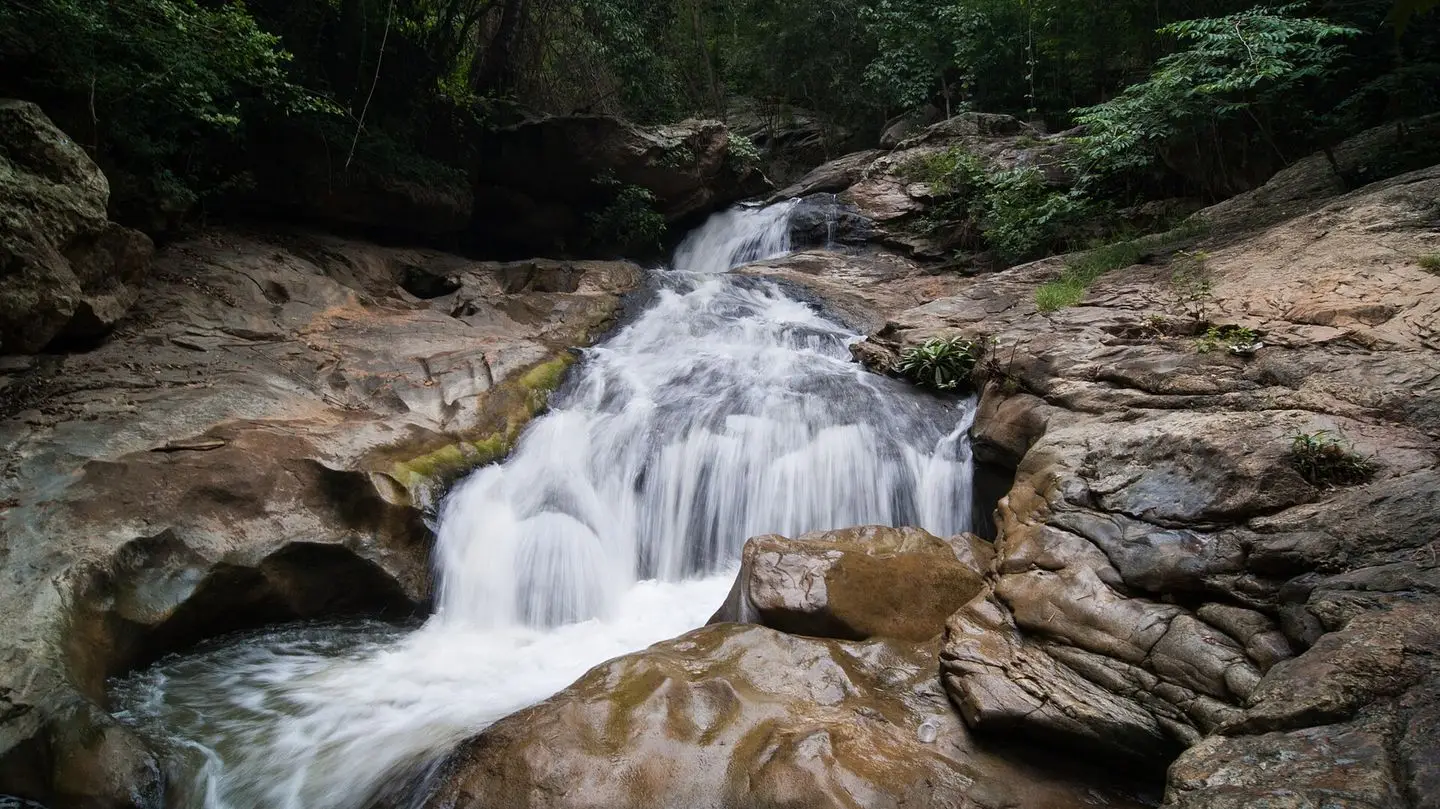
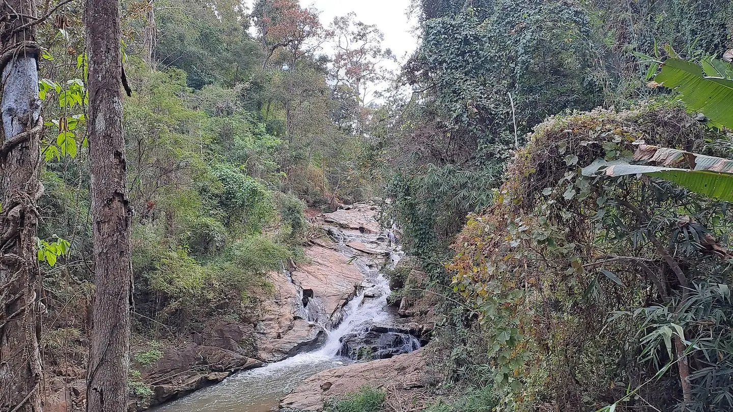
Tiers 1 to 5 are the easy half. From the car park a paved path with steps and a footbridge follows the stream past Pha Lat (tier 1, a broad slab of rock with shallow pools where families spread their mats), Wang Fai, Pha Taek and Wang Sam Muen to Wang Thao Phrom Ma at tier 5. The tiers here are 100 to 200 m apart and only a few metres high, but this is where the water collects into pools: tiers 2, 4 and 5 have the calm, shallow ones, with flat rocks to sit on. This is where you will swim, and on a weekend where everyone else will be too.
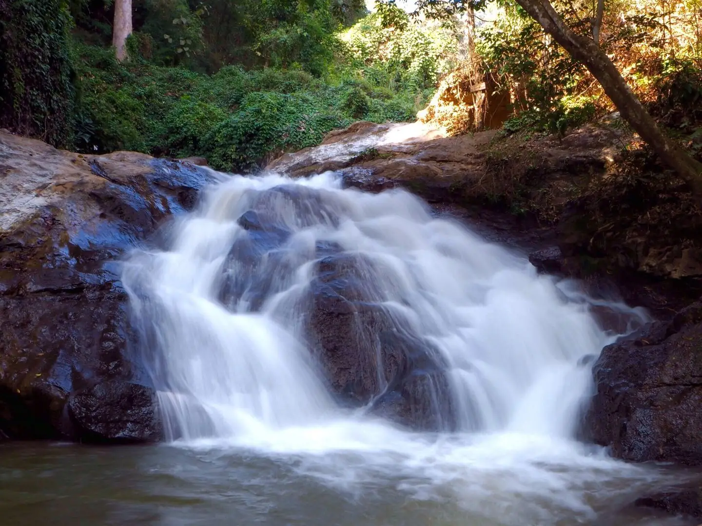
Tiers 6 to 10 are where the crowd thins out. Above tier 5 the path turns to packed earth and rock steps, steeper, with tree roots and a rope hand-line on the slippery sections, so you want shoes with grip rather than flip-flops. Tat Moei (6) and Tat Phanarom (7) are the photogenic pair, 6 to 8 m drops over terraced rock. Pha Ngoep (8), about 1.3 km from the car park, is the tallest single drop of the ten, falling almost vertically into a narrow pool; if you only have energy for one of the upper tiers, make it this one. Wat Hang (9) is a thin curtain, and Lan Thoe (10) is a flat shelf of rock with a quiet pool at the end of the path, where you will often have the place to yourself. Then you turn round.
Time. A brisk walker does the lot in 60 to 90 minutes. With photographs, a swim and a sit, allow two to three hours, and carry water; there is nothing to buy above the car park.
Swimming, honestly. It is allowed in the lower pools where no sign says otherwise, and in the cool season, when the water is clear and low, it is lovely. In the rainy season the rules change by the hour. The stream comes down from a big catchment on the mountain, and a storm you cannot see can lift it in minutes: in August and September 2026 the park closed Mae Sa several times after flash floods, once after visitors standing in the pools were swept off the rocks, and once after a swimmer was carried downstream and pulled out by rangers. If the water is brown, rising or roped off, stay out of it, whatever the people next to you are doing. Expect leeches in the upper pools in the wet months.
Which bike
Any of our scooters does this ride without noticing it. The ADV 350, ADV 160 and PCX 160 are all ideal: comfortable on the four-lane stretch, relaxed on the valley road, two-up included. A Giorno is completely fine too, and so is a Click or a Giorno 125; the valley road gains 60 m in 7 km, and that is the whole climb. Solo or two-up, you will not be short of anything.
There is no real descent on this ride, so the only riding advice is for the rainy season: the valley road carries run-off and wet leaves for an hour after a storm, so keep the speed down and brake gently and early rather than hard. Every rental includes two helmets and the free under-seat bag with a first-aid kit and two rain ponchos, and there is no mileage limit. If you are choosing a model, the two-minute finder will do it for you.
When to go
Water. The falls are fed by rain on Doi Suthep–Pui, so they follow the monsoon. June to October is the full show: loud, brown after storms, and the most likely time for a closure. November to January is the sweet spot, with the rains finished, the pools clear and the flow still generous. By late February the stream is shrinking, and in March and April, the hot and smoky months, it is a trickle over warm rock; the pools are still there, and still cooler than the city, but the waterfall photographs you have seen were not taken then.
Crowds. Saturdays, Sundays and Thai public holidays bring families from the city with mats and coolers: fine at the car park, a queue on the upper path. On a weekday before 10:00 you walk up almost alone.
Rain. In the rainy season go in the morning, be off the upper path by 14:00 and on the bike by 15:00: the pattern is clear mornings and a late-afternoon storm, after which the valley road is slippery with run-off and leaves for an hour. The ponchos in the under-seat bag are for exactly this. More on riding in the rains here.
Costs (2026)
- Park entry: ฿100 per foreign adult, ฿50 per child; ฿20 and ฿10 for Thais.
- Vehicle fee at the booth: ฿20 per scooter (฿30 per car).
- Queen Sirikit Botanic Garden, if you add it: about ฿100 per foreign adult (2025 price), plus a vehicle fee.
- Mon Cham: free to ride up and look; the cafés and farm walks charge their own small fees.
- Food at the car park: stalls and a small restaurant, nothing fancy; bring your own water for the walk.
For a different kind of waterfall day, the Sticky Waterfalls north of the city let you climb the rock itself, and the pillar guide to the best things to do in Chiang Mai has the rest of the rides.
Quick questions
How far is Mae Sa Waterfall from Chiang Mai?
About 23 km from the Old Town: 16 km north on Route 107 to Mae Rim, then 7 km west on Route 1096. On a scooter it is 40 to 45 minutes each way, most of it waiting at traffic lights on the way out of the city.
How much is the entrance fee at Mae Sa Waterfall?
It is inside Doi Suthep–Pui National Park, so the park fee applies: ฿100 for foreign adults and ฿50 for children, ฿20 and ฿10 for Thais, plus ฿20 for a scooter at the booth (2026). Cash, and keep the ticket.
Can you swim at Mae Sa Waterfall?
Yes, in the lower pools where no sign says otherwise; tiers 2, 4 and 5 have the calm ones. Rangers close the water when it rises, and in the rainy season you should not get in if it is brown or climbing: in August and September 2026 the park shut the waterfall several times after flash floods swept people off the rocks.
How many levels does Mae Sa Waterfall have, and how long is the walk?
Ten, spread along about 1.5 km of path with roughly 130 m of climbing. A fit walker gets to tier 10 and back in 60 to 90 minutes; with stops and a swim allow two to three hours. The first five tiers are on a paved, nearly flat path; the upper five are on dirt and steps.
Is Mae Sa Waterfall worth visiting?
If you want a waterfall you can reach from the city in under an hour and swim at, yes. It is busy on weekends and the water is thin in March and April, so go on a weekday between July and January. For a bigger single drop you need Doi Inthanon; for a climb up the rock, the Sticky Waterfalls.
Can you ride a scooter to Mae Sa Waterfall?
Yes. It is paved the whole way and almost flat: Route 107 out of Chiang Mai to Mae Rim, then Route 1096 for 7 km. The waterfall has scooter parking by the first tier. Any automatic scooter does it with ease, solo or two-up.