Mae Kampong by scooter: the mountain village day trip from Chiang Mai
A tea village in a steep valley 52 km east of the city, with a temple hall standing in a stream. The road out, the hot springs on the way, the steep finish, where to leave the scooter and how to dodge the weekend queue.
Tap a numbered stop for details. The route line is indicative — grab an offline map for turn-by-turn.
Mae Kampong is a village of wooden houses strung along a stream in a steep, forested valley, about 52 km east of Chiang Mai. It made its living from tea for a century, then from coffee, and now mostly from people like you coming up for the cool air, a bowl of khao soi and a walk to the waterfall.
It is one of the better day rides from the city: an hour and a half each way, paved to the last metre, flat and easy for 40 km and properly steep for the last few. This is the loop we would ride, out through San Kamphaeng with a stop at the hot springs and home through Doi Saket, with the map and the parts that need care.
The route at a glance
- 1Tha Phae Gate (Old Town) Start. Cross the river on Charoen Muang Road and keep going east: it becomes Route 1006, the old San Kamphaeng road.
- 2Bo Sang (umbrella village) About 11 km out. The paper-umbrella workshops are 500 m up the side road on the left; ten minutes is enough on a riding day.
- 3San Kamphaeng Hot Springs 4 km off Route 1317, signed. Two geysers, a warm stream for your feet and eggs boiled in the spring. ฿100 for foreign adults (2026).
- 4Ban Huai Kaeo turn-off Route 1317 ends here in Mae On's last flat village. Fill the tank, then follow the signs for Mae Kampong: 10.5 km and about 470 m of climbing to go.
- 5Teen Tok Royal Project Coffee country starts here. Just after it the road forks; keep right. From the fork it is 3.5 km and 240 m up to the village, the steep part.
- 6Mae Kampong village Park near Wat Khantha Phueksa, the temple with the small hall standing in the stream, and do the village on foot. No entry fee.
- 7Mae Kampong Waterfall 1 km above the temple on the same road, past the view cafés. Seven short tiers in deep shade, with steps up the side.
- 8Kew Fin viewpoint 3 km beyond the waterfall and nearly 400 m higher, on the Chiang Mai–Lampang ridge at 1,517 m. Very steep concrete; free. A dawn spot more than a day-trip one.
- 9Doi Saket (Route 118) The way home: back down to Ban Huai Kaeo, north on the country road to Route 118, then the highway through Doi Saket into town.
The day, leg by leg
Old Town → Bo Sang → Route 1317
East over the river on Charoen Muang Road, which turns into Route 1006. Shops, traffic lights and San Kamphaeng town for the first half hour; a quick look at the umbrella workshops in Bo Sang if you want one. About 26 km from the moat the road meets Route 1317: turn left.
Route 1317 → hot springs → Ban Huai Kaeo
Open two-lane road through rice fields and low hills. The hot springs are signed on the left about 8 km up; allow 45 minutes for the geysers, a foot soak and a basket of eggs. Back on 1317 it is another 8 km to Ban Huai Kaeo, where the highway ends. Fuel here.
Ban Huai Kaeo → Mae Kampong
Seven gentle kilometres up the valley to the Teen Tok Royal Project, keep right at the fork, then 3.5 km of steep bends through the forest to the village. Park by the temple or the community car park and walk from there.
The village, the waterfall, lunch
Temple first, then the lane up past the food stalls to the view cafés and the waterfall, 1 km above the temple. Lunch on the way back down. If Kew Fin is on your list, do it from the waterfall: 3 km further, steep all the way.
Home through Doi Saket
Back down the hill slowly, on the brakes in short squeezes. At Ban Huai Kaeo turn right instead of left and follow the country road 9 km north to Route 118. Left on the highway, 32 km of fast dual carriageway through Doi Saket to the moat. Leave the village by 16:00 and you are home in daylight.
Why ride it
Mae Kampong has about 120 households and one lane, which follows a stream down a valley so steep that most houses have their front door on one level and their kitchen on another. For most of its hundred-odd years the village lived off miang, tea leaves that are fermented and chewed rather than brewed. When the taste for miang faded, the villagers planted coffee under the Royal Project in the 1980s, built a small hydro plant on the stream in 1983 that still feeds the grid, and then started taking guests into their own homes. That last idea worked better than anyone planned. On a Saturday in December the lane is a slow queue of cars from Bangkok.
It is still worth the ride, for three reasons. The air: the main street sits at roughly 1,000 to 1,100 m (the 1,300 m in every brochure is the upper end of the village land, not the lane), and it is noticeably cooler than the city in any month. The temple, which has an ordination hall standing in the stream. And the road, which gives you an easy hour through rice fields, a hot spring to break the journey and a short, steep climb through tea and coffee forest at the end. On a weekday, starting early, you get the village before the crowd does.
The road
The loop is about 110 km: 52 km out through San Kamphaeng, 53 km home through Doi Saket. Every metre is paved.
Out of town. From the Old Town cross the river and follow Charoen Muang Road east past the railway station. It becomes Route 1006, the old San Kamphaeng road: two lanes, shops on both sides, traffic lights and school traffic for the first half hour. It is slow rather than difficult. Helmets on both heads; checkpoints turn up on the roads out of town, the helmet fine is up to ฿2,000 per person, and riding without a licence is ฿500 with a receipt that covers you for three days (the licence rules are here).
Route 1317. About 26 km from the moat, past San Kamphaeng town, the 1006 meets Route 1317. Turn left. Now it is a different ride: an open road through paddies and low wooded hills with very little traffic, 16 km to the village of Ban Huai Kaeo, where the highway simply stops. The hot springs are signed off to the left about halfway along.
The climb. At Ban Huai Kaeo follow the signs for Mae Kampong. The first 7 km rise gently up the valley to the Teen Tok Royal Project. Just beyond it the road forks; keep right. From there it is 3.5 km and about 240 m of climbing to the village: narrow, shaded, with tight bends and a few short, sharp ramps. The surface is good. The difficulty is other people: minivans and pickups coming down in the middle of the road. Stay left, stay slow, and use the horn before blind corners the way the locals do.
Coming down is where you need to pay attention. Keep the speed low from the top, brake in short squeezes rather than holding the levers, and if the brakes start to feel soft, pull over somewhere safe for ten minutes and let them cool. After rain the bends are slippery with leaves and moss in the shade; in the wet season add time and take it gently (more on riding in the rains).
Fuel. There are stations all the way to San Kamphaeng and along Route 1317. Fill up at Ban Huai Kaeo before the climb; there is nothing reliable above it.
The stops
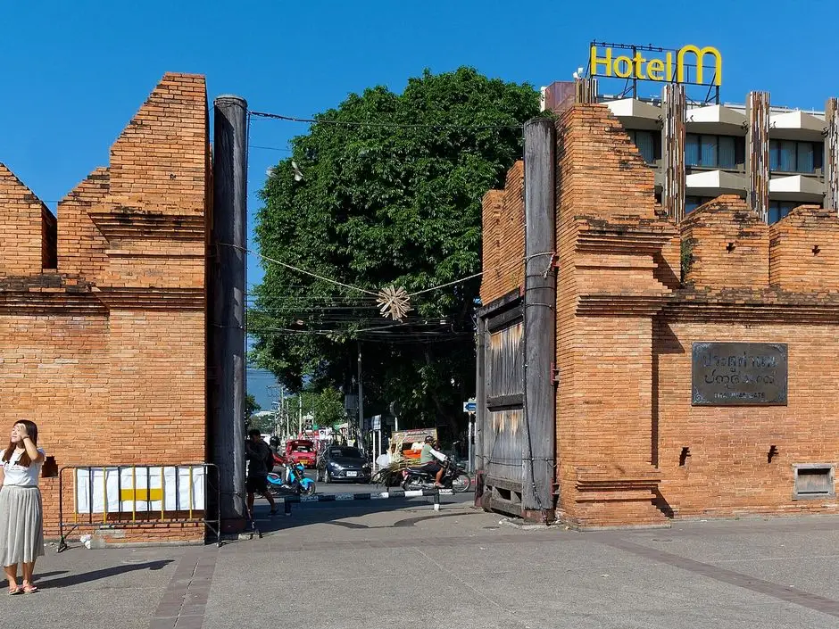
1. Tha Phae Gate
The map starts at the Old Town's east gate, which points you the right way already: straight on down Tha Phae Road, over the river, and on to Charoen Muang Road. Leave by 08:00 and you are in the village before the tour vans.
2. Bo Sang
Eleven kilometres out, a side road on the left leads to Bo Sang, the village that makes Chiang Mai's painted paper umbrellas. The workshops are 500 m up the road and free to walk around. On a day with a mountain at the end of it, ten minutes is plenty. It gets a proper visit on a shorter ride.
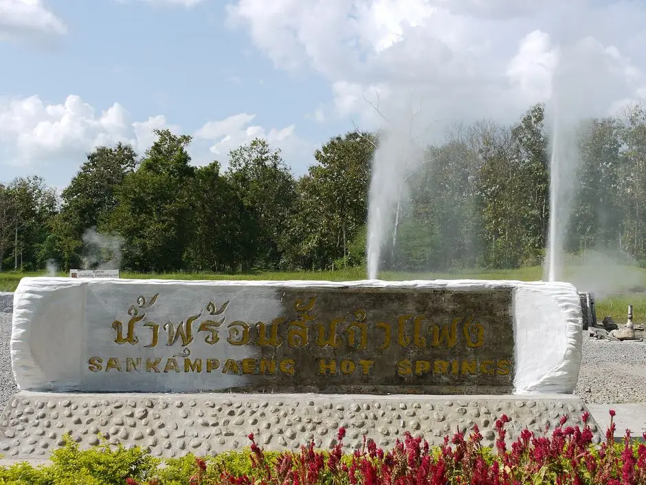
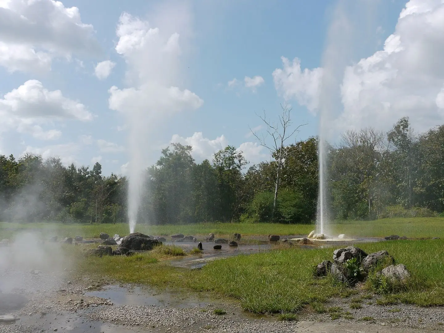
3. San Kamphaeng Hot Springs
Four kilometres off Route 1317, in a tidy park of lawns and flower beds, two geysers throw hot mineral water high into the air. It is more of a family picnic ground than a spa, and that is the charm. You buy a small basket of eggs at the kiosk, hang it in the boiling pool, and sit with your feet in the warm channel that runs through the park while they cook. Entry is ฿100 for foreign adults and ฿50 for children (2026, from the park's own price list); the mineral swimming pool is another ฿100 and a private bath room ฿65. Forty-five minutes is enough. Check Google Maps for today's hours.
4. Ban Huai Kaeo
The last flat village, where Route 1317 ends. Fuel, water, and a look at the sky: if the hills ahead are inside a black cloud, have a coffee and give it half an hour. Mountain showers pass.
5. Teen Tok Royal Project
Seven kilometres up the valley the forest closes in and the first coffee signs appear. The Royal Project centre at Teen Tok is where the valley's coffee growing started, and it has a restaurant if you are early. The fork is just beyond it. Keep right for Mae Kampong.
6. Mae Kampong village
The road delivers you to the lower end of the village, by the school, the visitor centre and the temple. Park here. The lane beyond is narrow and steep and full of people walking in the middle of it, and everything worth seeing is within a kilometre.
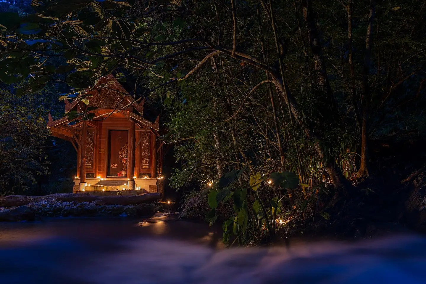
Start at Wat Khantha Phueksa, the village temple. It began as a hermitage around 1925 and became a temple in 1930. The viharn is carved teak in the Lanna style, and beside it is the thing people come for: a tiny ordination hall standing in the stream itself, with water running round it. The water serves as the hall's sacred boundary, an old practice, and this is said to be one of only two such halls left in the north. Shoulders and knees covered, as at any temple.
Then walk up. The lane climbs beside the stream past houses selling what the village has always sold and a few things it has not: miang, tea pillows, local coffee, sai ua (northern sausage) off the grill, kai pam (egg cooked in a banana-leaf cup over charcoal) and bowls of khao soi for ฿80–90 (2026). It is honest food at fair prices, and it is lunch. Higher up are the view cafés on stilts over the rooftops; Rabiang View is the famous one and has the queue to prove it. The coffee in the village is local and generally good. Most cafés close by late afternoon.
What to skip: the photo queues. Half the visitors are here for one picture on one balcony. Walk 200 m past any of them and you have the stream to yourself.
7. Mae Kampong Waterfall
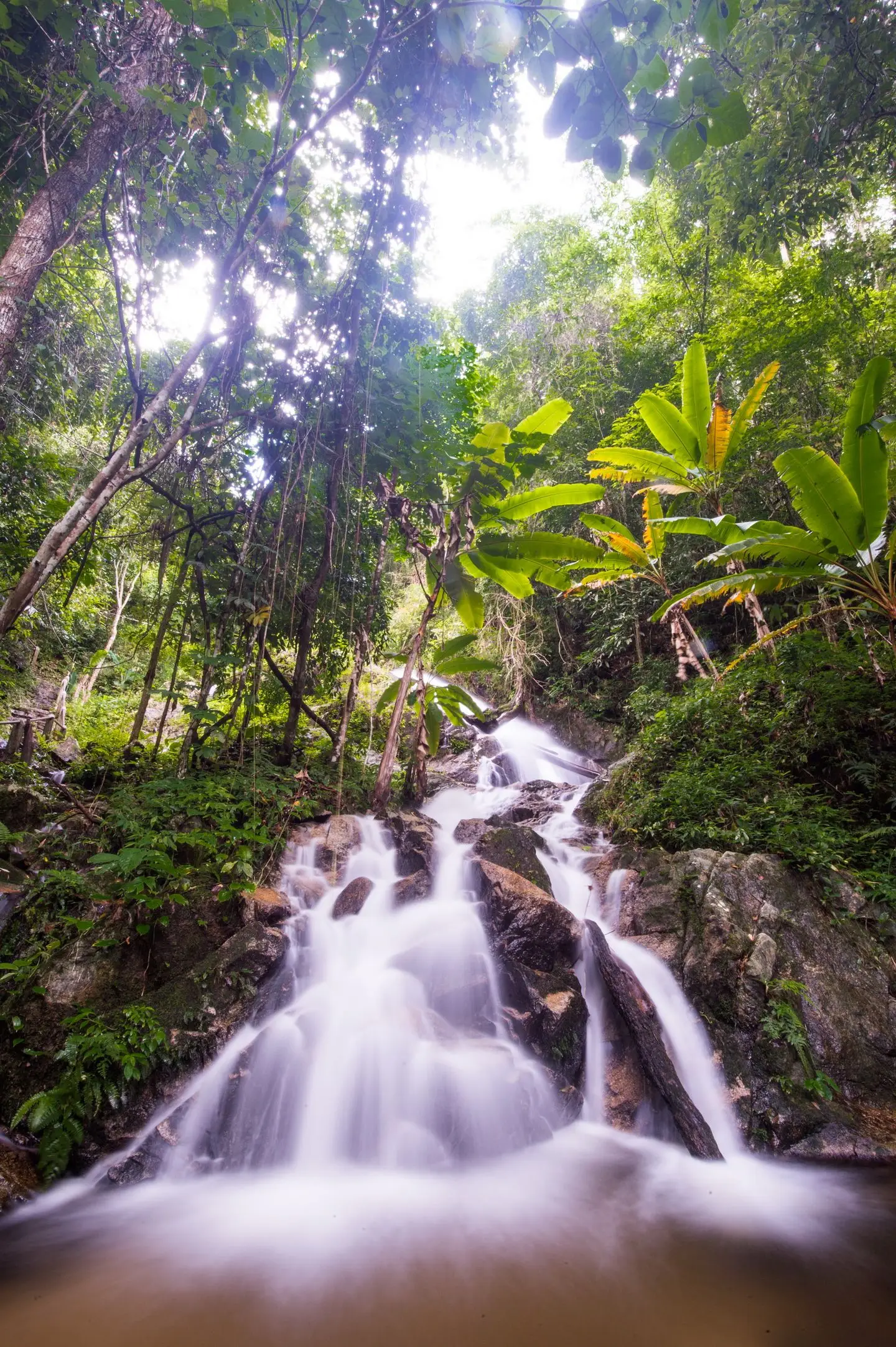
One kilometre above the temple, on the same road, the stream comes down through the forest in seven short tiers. It is not big. It is cold, shaded and loud, with steps climbing beside it to the upper levels, and on a hot-season day it is exactly where you will want to be. You can ride up; there is a little space by the road near Chom Nok Chom Mai and Teddu Coffee, the two cafés at this end. The steps are wet in every month, so wear shoes with grip. We know of no ticket desk here, but carry small notes in case the village has put a donation box out.
8. Kew Fin viewpoint (optional)
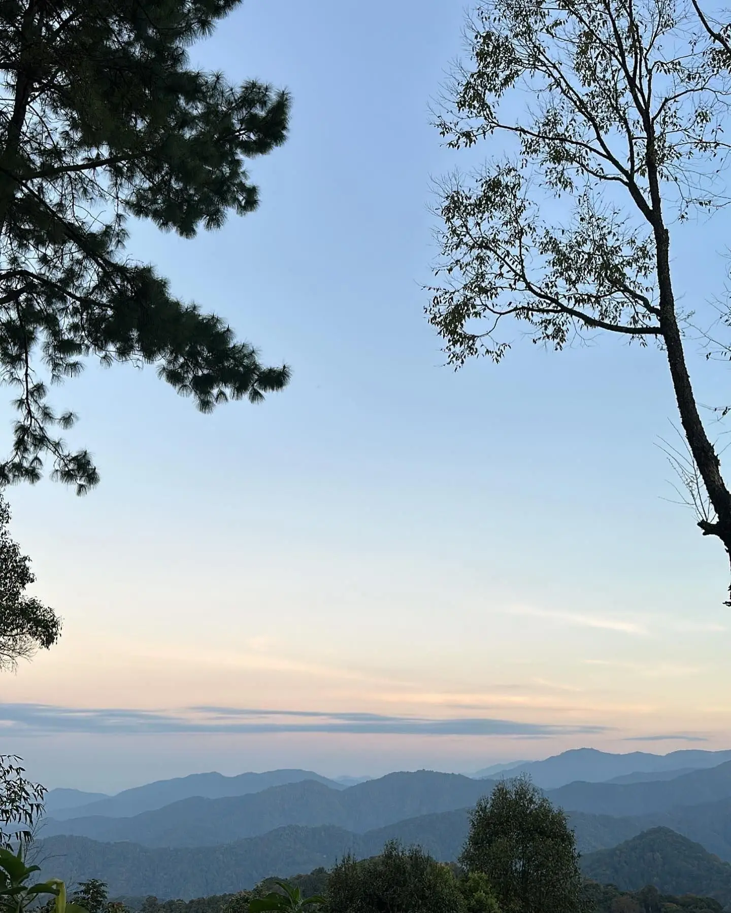
The road carries on past the waterfall to the ridge that divides Chiang Mai from Lampang. Kew Fin, at 1,517 m, looks east over the Chae Son hills and is where the sea-of-mist photos come from. It is free and there is no gate.
Two honest notes. First, the road: 3 km of narrow concrete that gains nearly 400 m, which is an average of 13 per cent with ramps well above that. It is the steepest thing on this route by a distance, and you have to come back down it. Second, the timing: the mist is a dawn event in the cool season. At 13:00 on a day trip you get a pleasant view of hazy hills. If you want Kew Fin properly, stay the night and go up at 05:30, on your own bike with care or in a village songthaew for about ฿100 a head.
9. Home through Doi Saket
You can go back the way you came. We prefer the loop: down to Ban Huai Kaeo, then right instead of left, and 9 km north on a quiet country road to Route 118. Turn left and it is 32 km to the moat on a fast dual carriageway. It is not pretty and the trucks do not hang about, so keep left and let them go. If there is light left, Wat Phra That Doi Saket, the hilltop temple above the town, is signed from the highway.
Which bike
The ADV 350, ADV 160 and PCX 160 are all ideal for this ride: comfortable for the 100 km of ordinary road and untroubled by the last 3.5 km, two-up included. A Giorno is completely fine too; the hill is short. A Click will do the job as well, particularly solo and travelling light: give it room on the ramps, do not stop on the steepest bits, and take the descent slowly.
Kew Fin is the exception, because that road really is steep. Two-up on a Giorno or a Click, we would leave the bike in the village and take the songthaew.
Every rental from us comes with two helmets and the free under-seat bag with a first-aid kit and two rain ponchos, and there is no mileage limit, so a 110 km day costs nothing extra. If you are choosing between models, the two-minute finder will narrow it down.
When to go
November to February is the season: clear, cool days, cold nights and mist in the valley at dawn. It is also when everyone else comes, so pick a weekday. Saturdays, Sundays and the whole of New Year week are a traffic jam with a view.
March and April are warmer and quieter, but from late February the smoke haze usually sits over the whole north and the altitude does not lift you out of it. June to October the valley is at its greenest and the waterfall at its fullest, and you may have the lane almost to yourself; pack the ponchos and expect a slippery hill.
Whatever the month, aim to arrive before 10:00 and to start down by 16:00. The village is at its best before the day visitors arrive, and the mountain road is not one to meet for the first time in the dark.
Staying the night
A day trip shows you the village at its busiest. The people who stay get the other one: the lane empty by 18:00, dinner at a homestay table, the stream as the only noise, and monks on their alms round in the mist at 07:00. The village has run homestays since its first days as a community tourism project, and there are now guesthouses and small lodges as well, with rooms from about ฿1,500 (2026). Book ahead for December and January, bring a jacket, and bring cash: there is no ATM in the village.
Costs (2026)
- Mae Kampong village: free.
- San Kamphaeng Hot Springs: ฿100 per foreign adult, ฿50 per child; mineral pool ฿100; private bath room ฿65.
- Kew Fin viewpoint: free. Village songthaew up, about ฿100 a head.
- Village songthaew from the lower car park on busy days: ฿100 return (2025 price).
- Lunch in the village: khao soi ฿80–90, grilled sausage and snacks from ฿25.
For more rides like this one, the Samoeng Loop is the classic half-day circuit west of town, and the pillar guide to the best things to do in Chiang Mai has the rest.
Quick questions
How far is Mae Kampong from Chiang Mai?
About 52 km from the Old Town by the San Kamphaeng road and Route 1317, or 50 km by Route 118 through Doi Saket. Either way it is roughly an hour and a half on a scooter, because the last 10 km are a mountain road.
Can you ride a scooter to Mae Kampong?
Yes. The road is paved all the way and the first 40 km are flat and easy. The last 3.5 km climb about 240 m through tight bends and need a steady hand, more so on the way down: keep the speed low and brake in short squeezes rather than holding the lever.
Is there an entrance fee for Mae Kampong?
No. It is a village, not a park, and walking around costs nothing; Kew Fin viewpoint is free too. The San Kamphaeng Hot Springs on the way charge ฿100 for foreign adults and ฿50 for children (2026).
Where do you park in Mae Kampong?
There is a community car park at the village entrance and space around the temple and visitor centre. On busy weekends cars are held at the bottom and visitors go up by village songthaew, ฿100 return in 2025. A scooter is much easier to place than a car, but park it once and walk: the lanes are narrow and steep.
Is Mae Kampong worth staying overnight?
If you want the mist, yes. Day visitors arrive mid-morning and leave by late afternoon, so the quiet evening and the early morning belong to people who sleep there. A night also makes sunrise at Kew Fin possible, which is the reason most people stay.
When is the best time to visit Mae Kampong?
November to February for cool, clear days and misty mornings, on a weekday if you can. The rainy season is green and quiet but the road and the waterfall steps are slippery. From late February to April smoke haze usually covers the north and the views go.