Doi Ang Khang by scooter: the cold-season ride to the Myanmar border
Mist, strawberries, sakura and the Myanmar border at 1,400 m — the cold-season ride, with the one road rule every scooter rider needs to know.
Tap a numbered stop for details. The route line is indicative — grab an offline map for turn-by-turn.
Doi Ang Khang is the ride we save for the cold season. About 150 km north of Chiang Mai, right on the Myanmar border, it's a high valley at 1,400 m where the Royal Project grows strawberries and sakura, the villages are Yunnanese Chinese, the dawn comes with a sea of mist, and the thermometer can touch zero. It feels like a different country — because for a long time, in every way that mattered, it was.
It's also the one ride in this series where the road choice genuinely matters. There are two ways up the mountain; one of them is a famous brake-cooker that the highways department itself tells automatic scooters not to descend. So this guide is as much about which road as what's at the top. Two days, November to February, and one of the best things you can do on two wheels in the north.
The route at a glance
- 1Chiang Mai Start. Route 107 north — fuel up before you leave.
- 2Chiang Dao Cave Lit cave chambers at the foot of Doi Luang (฿40, from 8am). Best coffee stop on the ride.
- 3Chiang Dao Last reliable fuel. The 1178 turn-off is at the Mueang Ngai junction just north of town.
- 4Arunothai Yunnanese Chinese village — lunch stop. The road carries on as the 1178 along the border all the way up.
- 5Royal Agricultural Station Angkhang The destination: gardens, strawberries, sakura in January. ฿50 entry.
- 6Ban Nor Lae 3 km north — strawberry slopes and the viewpoint into Myanmar. Go before 8am.
How to do it: two days on the mountain
Chiang Mai → Chiang Dao → Arunothai → Ang Khang
Leave by 7.30 and ride the 107 north to Chiang Dao (72 km). Do the cave and a coffee, fill the tank, then turn off at Mueang Ngai onto the 1178 to Arunothai for a Yunnan lunch. From here the same road climbs for 37 km along the border, then the last few kilometres on the top of the 1249 bring you into the station around 2pm. Wander the gardens, settle into Ban Khum or the campsite, then ride to Kiew Lom or Mon Son for sunset.
Dawn at the top, then home
Up before 6 for the sea of mist at Mon Son or Nor Lae — this is what you came for. Strawberries at Nor Lae before the pickers finish, Tea 2000 if you've got the legs, breakfast in Ban Khum. Then back down the 1178 the way you came (not the 1249 to Fang on a scooter), fuel at Chiang Dao, and home on the 107 by mid-afternoon.
Why bother riding this far
Because nothing else near Chiang Mai looks like it. The Ang Khang valley was settled by Kuomintang soldiers who crossed from Yunnan after 1949, and the King's Royal Project arrived in 1969 to replace opium with temperate crops — so what you ride into is a strange, lovely mix: Chinese villages with Yunnan noodle shops and tea houses, terraced strawberry fields, English rose gardens, an army base staring into Myanmar, and in mid-January more than five thousand Japanese and Taiwanese cherry trees in blossom. At dawn the valleys below fill with cloud. It's cold enough to see your breath. In Thailand.
The road — and the one rule
If you read nothing else, read this:
- Scooter (any automatic): up the 1178 via Arunothai, down the 1178. Same road both ways.
- Confident rider on a manual bike: up the 1249 from the Fang side, down the 1178.
- Never: down the 1249 on an automatic — and never the Nor Lae–Fang army road, on anything.
Everything starts the same way: Route 107 north past Mae Rim and Mae Taeng to Chiang Dao, about 72 km of easy, mostly flat riding. After that there are two roads up, and here's the rule: on a scooter, go up and down via Arunothai on Route 1178. Turn off the 107 at the Mueang Ngai junction (km 80, just past Chiang Dao) and then simply stay on the 1178: fast sweepers to Arunothai, and from there the same road carries on — narrow, winding and properly steep for about 37 km along the Myanmar border — until the last few kilometres, which run along the top of the 1249 into the station. (Older guides call the border stretch "Route 1340"; on Google Maps it's signed 1178 the whole way.) It's a real mountain road, but it's the sane one.
The other road is Route 1249 from the Fang side: 25 km from the 107 to the top, the last 15 of them brutal — sustained 10% with hairpins well over 20%. Riding up it on a 125cc is slow but fine. Riding down it on an automatic scooter is the problem: no engine braking, long steep descents, and brake fade that has put plenty of riders in the ditch. The highways department posted a notice specifically warning automatic bikes off the descent, and the people who ride this mountain every year say the same. So: the 1178 both ways on a scooter, or up the 1249 and down the 1178 if you're confident and the bike is fresh. And the short military back road from Nor Lae down to Fang — never, on anything.
Fuel: there's no petrol station on the mountain. Fill up in Chiang Dao on the way, and again at Fang or Chai Prakan if you come back that side. Budget around 160 km each way and about four hours with stops.
Stops on the way up
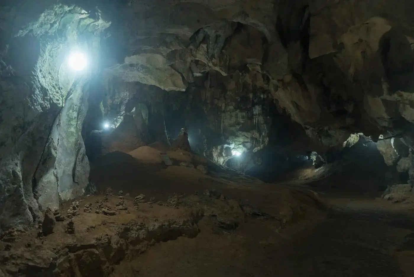
- Chiang Dao Cave — a few kilometres off the 107 at the foot of Doi Luang, Thailand's third-highest peak. ฿40 to walk the lit chambers, open from 8am, or hire a lantern guide for the deeper, darker tunnels. The coffee shops around the cave are the best break on the whole ride.
- Arunothai — the Yunnanese Chinese village where the 1178 swings north-east towards the border. Stop for lunch: hand-pulled noodles, steamed buns, Yunnan ham. From here the climb starts for real.
- The cherry road — from Arunothai up towards the station, the roadside is lined with wild Himalayan cherry (nang phaya suea khrong). In late December and January it's a pink tunnel.
At the top
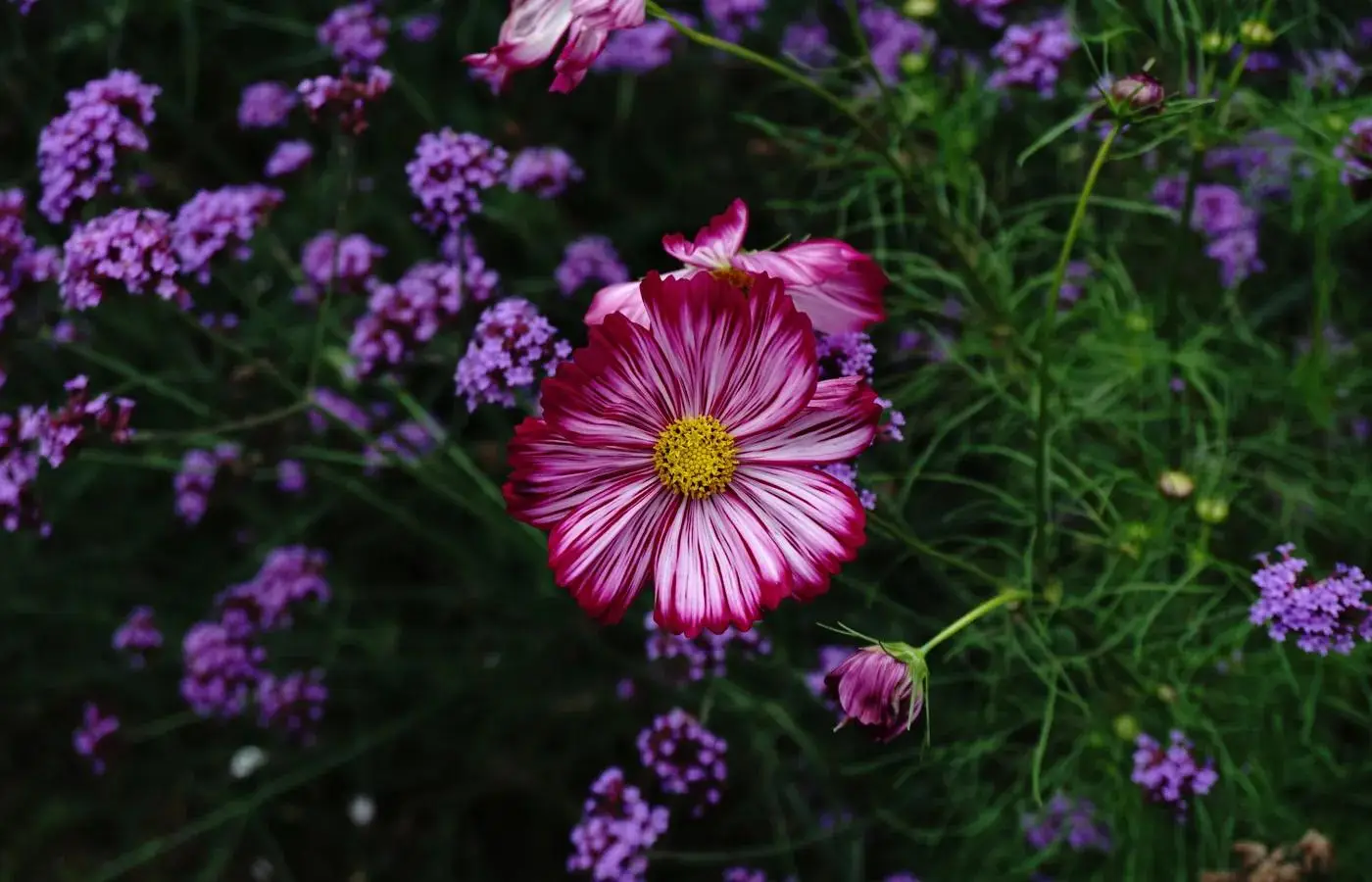
Royal Agricultural Station Angkhang is the heart of it: ฿50 to get in, open from 7am, and worth a slow couple of hours. Strawberry and temperate-fruit plots, greenhouses of flowers you don't expect at this latitude, a bonsai garden, an English rose garden, a tea shop, and — in the 80 Garden opposite the clubhouse — the famous sakura. In 2026 they peaked in the third week of January; the station posts updates, so time the trip if blossom is the point.
- Ban Khum — the village at the station gate: a little market, Yunnan restaurants, tea tasting, an ATM, and most of the guesthouses.
- Ban Nor Lae — 3 km north, the end of Thailand. A Palaung village with strawberry fields on the slopes (the pickers are out from dawn — go before 8am), an army post on the ridge, and a viewpoint that looks straight across the valley into Myanmar. The border checkpoint itself is off-limits to foreigners; the view isn't.
- Mon Son and Kiew Lom viewpoints — the two sunrise spots, both in Doi Pha Hom Pok National Park (foreigners ฿300 park entry). Mon Son faces east over the sea of mist and has a campsite with tent rental; Kiew Lom works for sunset too. Be there before the light, in every layer you own.
- Tea Plantation 2000 at Ban Khob Dong — free, open 8am–4pm, a steep fifteen-minute walk down into terraced tea. Mind the road: it's narrow and it bites.
Sleeping up there
Don't try this as a day trip — it's 300 km of mountain riding and the whole point is dawn. The classic move is to camp: the Royal Project campsite rents tents from around ฿250 (or charges a small fee to pitch your own), and the national-park sites at Mon Son and Kiew Lom do tent-plus-mat-plus-sleeping-bag packages for about ฿300 with the entry fee. Otherwise there are simple guesthouses in Ban Khum from ฿600–1,500 a night. Weekends in December and January are rammed — book, or go midweek. (The old Angkhang Nature Resort is gone, so ignore it in older blogs.)
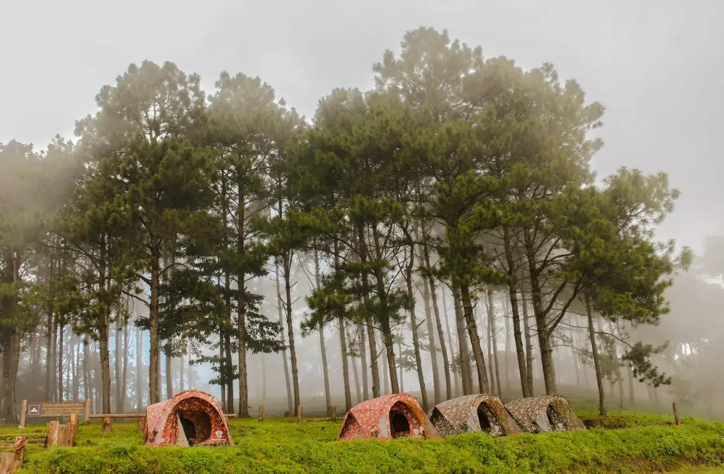
It gets cold — the record is −3°C, frost on the strawberry nets isn't unusual in January, and a normal dawn is 3–8°C. Riding gloves, a windproof layer and a buff are not optional. You will laugh at this advice at the Chiang Dao petrol station and thank us at 6am.
What bike should you take?
A Click 125 will make it — people do it every winter — but this is the ride where a bit more bike earns its keep. A PCX 160 or ADV 160 climbs the 1178 without wheezing and has the brakes for the way down; the ADV 350 turns the whole thing into a comfortable tour. Whatever you ride: fresh tyres, strong brakes, a recent service. On the descents, go slowly in short bursts and let the brakes cool rather than dragging them — if the lever starts to feel long or soft, pull over for fifteen minutes. That's not caution, that's physics. We run new models only and deliver anywhere in Chiang Mai; see the range and prices here.
When to go
November to February, and ideally December–January: cold, clear, mist in the valleys, strawberries in the fields, cherries on the road and — mid-January — sakura at the station. March and April are hazy and hot with burning-season smoke, and the view disappears. The rainy season (May–October) is green but the mountain roads wash out — the 1249 was closed for most of a year after slides in 2018 — so it's a no.
Riding it safely
- Never ride the climb or the descent in the dark. Fog rolls in fast up here and the drops are real.
- Descend on the 1178, not the 1249 — unless you're on a manual bike and know exactly what you're doing.
- Brakes over speed. Short, firm braking with cooling pauses beats a long drag every time.
- Fuel up in Chiang Dao. Nothing on the mountain.
- Phone signal comes and goes — download the map offline before you leave town.
Done it and want more? This is the northern cousin of the Mae Hong Son Loop — and if you're new to mountain riding here, the Samoeng Loop is the right warm-up first.
Quick questions
Can you ride to Doi Ang Khang on a scooter?
Yes — via Arunothai on Route 1178, both up and down. A 125cc automatic will make the climb; a PCX 160 or ADV 160 is more comfortable. Don't descend Route 1249 (the steep Fang-side road) on an automatic scooter — brake fade is a real risk and the highways department advises against it.
How far is Doi Ang Khang from Chiang Mai?
About 160 km each way via Chiang Dao and Arunothai — roughly four hours of riding with stops. It's a two-day trip: the mountain roads and the dawn mist make a day trip pointless.
When is the best time to visit Doi Ang Khang?
November to February, ideally December–January: cold clear mornings, mist in the valleys, strawberries, roadside cherry blossom and the station's sakura, which peaks around mid-January. Skip burning season (March–April) and the rainy season, when the roads wash out.
How cold does it get at Doi Ang Khang?
Properly cold for Thailand — a normal cool-season dawn is 3–8°C, frost is common in January and the record low is −3°C. Bring riding gloves, a windproof layer and a buff; you'll need them for the sunrise viewpoints.
Where do you sleep at Doi Ang Khang?
Camp at the Royal Project site (tents from about ฿250) or at the Mon Son / Kiew Lom national-park sites (around ฿300 with tent and entry), or take a simple guesthouse in Ban Khum for ฿600–1,500. Book ahead for December–January weekends.