Chiang Dao by scooter: the cave, the hot spring and the mountain
A limestone mountain 70 km north of the city, with a cave temple, a forest monastery up 510 steps, a free hot spring and a Tuesday market at its foot. The road, the stops, the costs and a two-day plan.
Tap a numbered stop for details. The route line is indicative — grab an offline map for turn-by-turn.
Chiang Dao is the first place north of Chiang Mai where the landscape changes its mind. For 40 km the road runs through towns and flat farmland, then the hills close in, the Ping valley narrows, and a wall of grey limestone appears ahead: Doi Luang Chiang Dao, 2,175 m, the third-highest mountain in Thailand. The town at its foot is small and sleepy, and the things worth seeing sit in a cluster under the cliffs: a cave temple you can walk into, a forest monastery reached by 510 steps, and a hot spring where the mountain's water comes out hot for free.
It is 70 km to the town and 75 km to the cave from the Old Town, about an hour and three-quarters on a scooter, on a road with no real hill in it. You can do it as a long day. We think it is better as two short ones, with a night in a guesthouse under the mountain and the temple steps at dawn. Here is the road, the stops and the plan.
The route at a glance
- 1Tha Phae Gate (Old Town) Start. Out of the moat at the north-west corner and onto Chotana Road, which is Route 107 and stays Route 107 all the way to Chiang Dao.
- 2Mae Malai (Route 1095 junction) 34 km out, through Mae Rim. The traffic lights where the Pai road leaves to the left. Fuel, a market, coffee; you carry straight on.
- 3Mae Taeng The last proper town for 34 km. The four-lane road ends here; beyond it the 107 is two lanes through wooded hills and then the Ping valley.
- 4Chiang Dao town A strip of shops along the highway at 70 km. Fuel, lunch, the Tuesday morning market by the bus station, and the turn-off west to the cave.
- 5Chiang Dao Cave (Wat Tham Chiang Dao) 5 km from town under the cliffs. A lit walk to a reclining Buddha, then the dark caves with a lantern guide. ฿40 entry, about ฿200 per group for the guide (2026).
- 6Wat Tham Pha Plong 2 km on from the cave, up a short steep lane. 510 steps through forest to a chedi on the cliff. Free; best at first light.
- 7Yang Pu Tao hot spring 6 km back south past the cave, beside the wildlife research station. Concrete tubs of hot mountain water, free, no facilities; paid pools with gazebos next door for about ฿50.
- 8Mueang Ngai 12 km north of town on the 107. Village, temple and the start of the Route 1178 road over the mountains to Mueang Khong and Wiang Haeng, a full third day.
- 9Pong Arng hot spring (Pha Daeng National Park) 30 km north of town via the 107 and 1178. Two forest pools in the national park, ฿100 for foreigners (2026); the ticket covers Si Sangwan waterfall 3 km further on.
The two days, leg by leg
Old Town → Mae Malai → Mae Taeng
Chotana Road north out of the city, four lanes, shops and lights through Mae Rim. Leave by 08:00 and you miss the worst of it. At Mae Malai the Pai road peels off left; fill up here or in Mae Taeng, 4 km on, where the dual carriageway ends.
Mae Taeng → Chiang Dao town
Two lanes now, and the best riding of the trip: a wooded climb of about 80 m through the hills north of Mae Taeng, a drop to the Ping, then an easy run up the valley with the mountain growing ahead at every bend. Lunch in town; the market if it is Tuesday.
Chiang Dao town → the cave → guesthouse
West from the highway on the cave road, under the big trees, to the temple at the foot of the cliff. Lit section first, then a guide and a lantern for the dark caves. Check into a guesthouse in the cave village before dark and watch the mountain change colour.
Wat Tham Pha Plong at dawn
Up the lane beside the cave to the monastery car park, then 510 steps through the forest. In the cool season the valley below is mist and the chedi is above it. Back down for breakfast in the village.
Hot spring → Chiang Dao town → home
South on the Mae Na road to the free tubs at Yang Pu Tao for a soak, then back to the 107. Fuel in town, and the same road home with the afternoon sun behind you. Aim to be inside the city by 16:00, ahead of the evening traffic.
North: Pong Arng, Mueang Ngai, the Mueang Khong road
Pong Arng hot spring in Pha Daeng National Park is 30 km north. The Route 1178 road from Mueang Ngai over the mountains to Mueang Khong and Wiang Haeng is a long, quiet, beautiful day with nothing much at the end of it, which is the point. Passport in the pocket; this is checkpoint country.
Why ride it
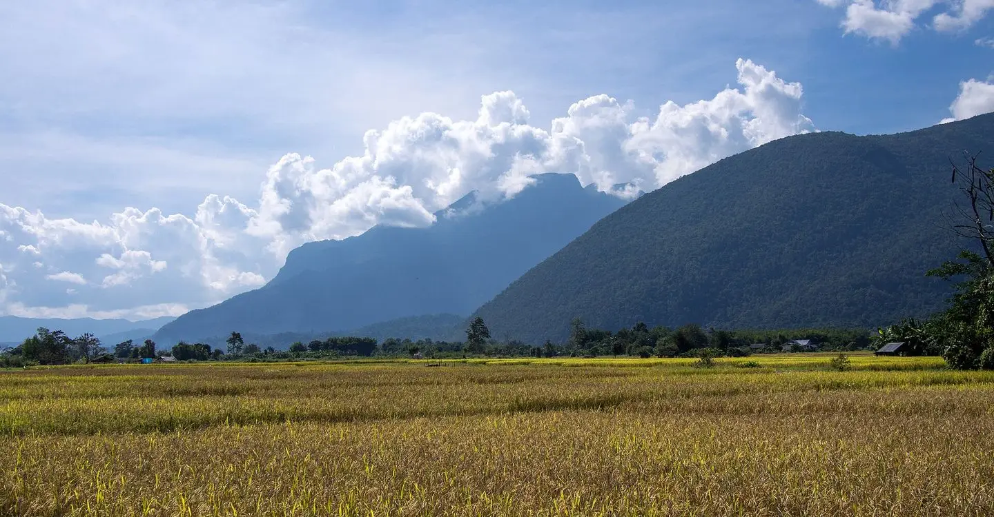
Most rides out of Chiang Mai are about the road. Chiang Dao is about the destination. The road is a highway with modest hills, and then, 60 km out, the mountain appears and does not go away. Doi Luang Chiang Dao is a limestone massif, not a rounded forest hill like Doi Suthep: a grey wall with a serrated top, 2,175 m high, with the little town and its rice fields at the foot. The whole massif is a wildlife sanctuary of 521 km² and, since 2021, a UNESCO biosphere reserve.
You cannot ride up it, and outside a short cool-season window with a permit you cannot walk up it either. What you can do is sit under it. The cave temple at its base is one of the better caves in the north, half shrine and half proper underground walk; the forest monastery on the cliff above has 510 steps and a chedi that stands over the morning mist; the hot spring runs the mountain's water into concrete tubs for nothing; and on Tuesdays the hill villages come to town for the market. Together, with a night under the cliffs, it is one of our favourite two-day trips. It shares its first 34 km with the road to Pai and Doi Ang Khang.
The road
Route 107, Chotana Road, is the highway north to Fang and the border, and the only road you need: 75 km from the moat to the cave, every metre paved, a total climb of barely 150 m (the city sits at 310 m, the cave at 455 m).
The city to Mae Taeng (38 km). Leave the moat at the north-west corner and follow Chotana Road north. It is four lanes with a central divider through Mae Rim to Mae Taeng: shops, traffic lights, minivans bound for Pai, lorries bound for the border. Busy rather than difficult: keep left, hold a steady speed and let the trucks go. Leave by 08:00 and most of it is still asleep. At Mae Malai, 34 km out, the Pai road (Route 1095) goes off left at a set of lights; fuel, a market and coffee, and you carry straight on. Mae Taeng, 4 km later, is where the dual carriageway ends.
Mae Taeng to Chiang Dao (34 km). The road drops to two lanes, the traffic thins to a third of what it was, and almost at once it climbs into wooded hills: an easy 80 m of winding, shaded road, with a few bends that stay damp and slippery in the rains. Then it drops to the Ping and the last 20 km are an easy run up the valley with the mountain filling more of the view at every bend. The surface is good throughout. Fuel is in Mae Taeng and again in Chiang Dao town, 34 km apart, with a couple of small stations between.
Police. There is a police box on the highway just before Chiang Dao and checkpoints come and go nearer the city. The rules are the usual ones: two helmets on two heads (the fine is up to ฿2,000 a head) and a licence that covers a motorbike; riding without one costs ฿500 at a checkpoint and the receipt works as a three-day pass (the licence rules in full). North of Chiang Dao town, on the road towards Fang and on the border roads, the checkpoints are military and may ask to see a passport. Carry it and you are through in a minute.
The cave road. In the middle of town a signed road leaves the highway westward, passes under an avenue of big old trees (tour vans stop in the middle of it for photos; ride slowly) and reaches the temple at the foot of the cliff after 5 km. The lane up to Wat Tham Pha Plong leaves from beside the cave and climbs 100 m in 2 km, the only steep bit of the trip. Coming back down, keep the speed low and squeeze the brakes gently rather than holding them.
The stops
1. Tha Phae Gate
The map starts at the east gate; the road you want leaves from the north-west corner of the moat. Fuel up on the way out.
2. Mae Malai
The junction town, 34 km out, where everyone going to Pai turns left. Coffee and a full tank here or in Mae Taeng; after the lights the road is yours.
3. Mae Taeng
The last town on the four-lane road and the last easy fuel for 34 km. The hills start the moment the road narrows.
4. Chiang Dao town
Chiang Dao is a strip of shops and noodle stalls along the highway with the mountain looking over the roofs: fuel, lunch, an ATM, a 7-Eleven. On Tuesday mornings it also has the market, half a kilometre of stalls along both sides of the road near the bus station, where people from the hill villages sell vegetables, clothes, tools and orchids in pots. It runs from early until about midday and is quieter in the rains. Time the ride for a Tuesday if you can; it is the most local thing on this trip.
5. Chiang Dao Cave
The cave is a temple, Wat Tham Chiang Dao, and feels like one: a pond of fat carp at the entrance, a row of old chedis, a staircase up into the cliff and incense in the air. Shoulders and knees covered, as at any temple; there are sarongs at the gate (฿20) if you forgot. Entry is ฿40 for foreigners and ฿20 for Thais (2026), cash only. Check Google Maps for today's hours.
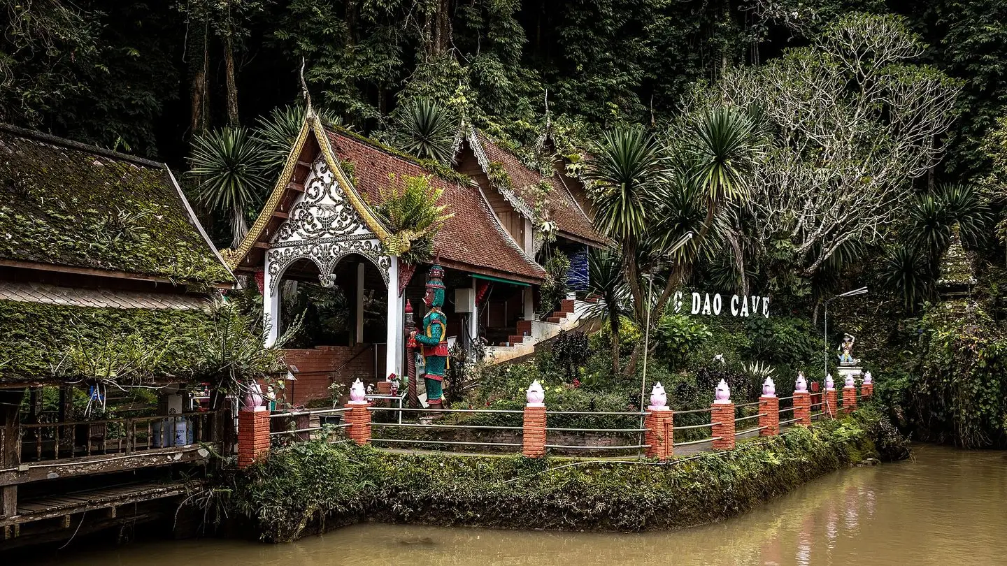
There are two visits in one. The first is the lit section: a couple of hundred metres of wide, cool passage with electric lights, shrines and Buddha images, ending at a reclining Buddha. You do this on your own in twenty minutes. The second is the dark caves beyond, where the lights stop. For these you take a guide, who waits at the junction with a gas lantern: about ฿200 per group of up to five (2026) and a tip of ฿100 or so on top. She leads you through about 700 m of tunnels and chambers, pointing the lantern at formations that look like an elephant or a throne and telling you when to duck. It is proper caving in a gentle way: a few places where you crouch, a few where the lantern cannot find the ceiling, bats in the deeper rooms. Allow 45 minutes and wear shoes with grip, not flip-flops. The system runs for ten kilometres or more; you see a small, well-chosen slice.
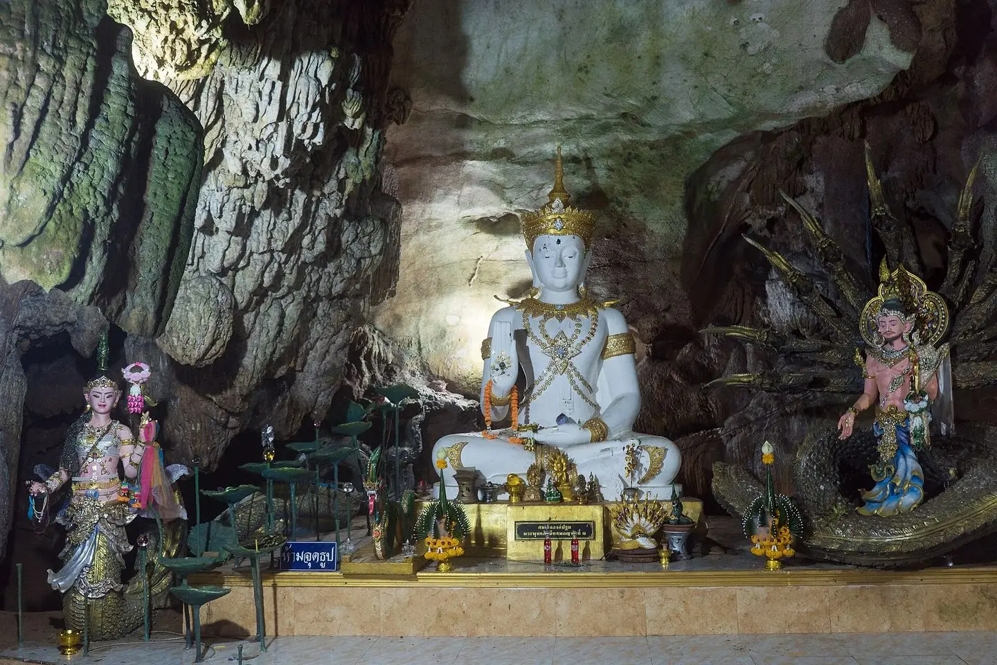
What to skip: the middle of a hot April afternoon, when the tour groups arrive and the lit section becomes a queue. Go in the morning.
6. Wat Tham Pha Plong
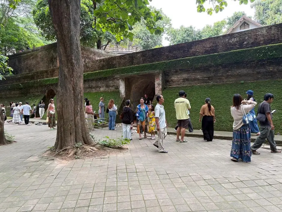
Two kilometres on, up a short steep lane, a staircase disappears into the forest. Wat Tham Pha Plong is a working forest monastery, founded in 1967 by Luang Pu Sim, a respected meditation monk of the forest tradition, who lived here until his death in 1992. The 510 steps climb through tall trees past rest huts and small signs with sayings in Thai and English to a cave shrine and a white and gold chedi on the lip of the cliff. From the top you look down over the valley and across to the town; in the cool season at 06:30 the valley is a sea of mist and you are above it.
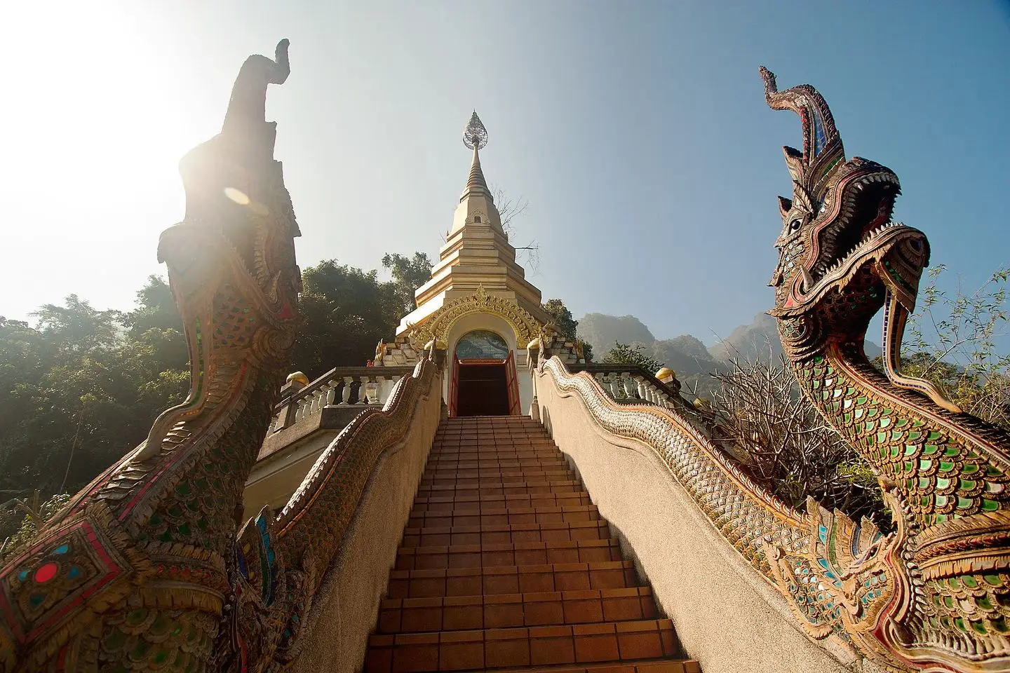
It is free (there is a donation box) and the climb takes twenty minutes, thirty if you read the signs. Monks live and meditate here: keep your voice down and cover shoulders and knees. This is the reason to stay the night; from the city you cannot be here at dawn.
7. Yang Pu Tao hot spring
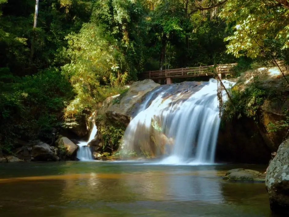
Back past the cave and 4 km south on the Mae Na road, by the wildlife research station, hot water comes out of the ground into a row of concrete tubs under the trees. It is free, always open, and there is nothing else: no changing room, no toilet, no shop. The water flows from tub to tub, each cooler than the last; find the one you like and look at the cliffs. Next door a family has built proper pools with bamboo gazebos for about ฿50 (2026), the better choice if you want some privacy. Bring a towel either way.
8. Mueang Ngai (detour)
If you have a third day, it starts here, 12 km north on the 107: an old village with a temple and a memorial stupa to King Naresuan, where Route 1178 turns west over the mountains to Mueang Khong and Wiang Haeng near the border, a long, quiet, empty loop with hardly a shop on it. Fuel up in town first and take the passport.
9. Pong Arng hot spring (detour)
The other third-day option: 30 km north on the 107 and 1178 into Pha Daeng National Park, where Pong Arng is two clear, hot forest pools beside a stream and not much else. Entry is ฿100 for foreigners (2026); the ticket also covers Si Sangwan waterfall, 3 km further up the road. There is no phone signal in the park, so download the map first.
Which bike
This is an easy road, and the ADV 350, the ADV 160 and the PCX 160 are all ideal for it: comfortable at highway speed for an hour and three-quarters, steady with a passenger and a bag, and untroubled by the one short hill up to Pha Plong. A Giorno is completely fine too. A Click 125 does the job as well; 70 km each way is comfortable on all of them, and the only place you notice a difference is the Pha Plong lane two-up.
On the few descents, the hills north of Mae Taeng on the way home and the Pha Plong lane, keep the speed down and feather the brakes gently rather than holding them. Every rental from us comes with two helmets and the free under-seat bag with a first-aid kit and two rain ponchos, and there is no mileage limit, so 150 km and a night away cost nothing extra. Our online booking covers the city, so if you want the scooter delivered to a guesthouse in Chiang Dao rather than to your hotel in Chiang Mai, message us first. Still choosing? The two-minute finder will sort it out.
When to go
November to February is the season. The air is cool, the mountain stands clear against the sky in the morning, the valley fills with mist at dawn and Pha Plong floats above it. It is also when the guesthouses fill up, so book ahead, and bring a jacket: Chiang Dao at 06:00 in January is close to 10 °C. Gloves and a windproof layer make the first half hour a pleasure instead of a test.
March and April are hot and hazy: the burning season settles smoke over the north and by midday the mountain is often a grey shape. The cave does not care about the air, 20 °C and dark whatever happens outside, and the hot spring is as good as ever. Ride early while the light is clearest, mask on for the highway on bad days, and spend the middle of the day underground.
June to October is the rainy season: the mountain is often in cloud, the bends north of Mae Taeng are slippery, and the deeper caves can close for a few weeks when water rises in August and September; the lit section stays open and the valley is at its greenest. Ride in the morning, when most days are dry, carry the ponchos, give the shaded bends a little extra room, and keep the hot spring as the afternoon plan for when the clouds roll in.
Where to eat and sleep
Chiang Dao town has noodle and khao soi shops along the highway and the Tuesday market for breakfast if your timing is right; at the cave there are coffee stalls and a few simple family restaurants. Chiang Dao goes to bed early, and after a day on the bike and 510 steps, so will you.
Sleep in the cave village under the cliffs, where guesthouses, bungalows and small resorts have grown up over twenty years, most with a view of the mountain and a restaurant that feeds you after dark. It is where the two-day plan works: Pha Plong and the hot spring are minutes away. Rooms run from basic fan to proper lodge; in the cool season and at weekends book a day or two ahead, and bring cash, as the nearest ATM is in town.
Costs (2026)
- Chiang Dao Cave: ฿40 per foreign adult, ฿20 per Thai adult. Guide with lantern for the dark caves about ฿200 per group of up to five, plus a tip of ฿100 or so. Sarong hire at the gate, ฿20.
- Wat Tham Pha Plong: free; put something in the donation box.
- Yang Pu Tao hot spring: free. The private pools with gazebos next door, about ฿50 a person.
- Pong Arng hot spring and Si Sangwan waterfall (Pha Daeng National Park): ฿100 per foreign adult, one ticket for both.
- Doi Luang summit trek: cool season only, booked online through the Chiang Dao Wildlife Sanctuary before the season opens; fees and guides are set by the sanctuary. For 2026–27 the trail is open from mid-November to 12 February and the booking window was the last week of October; check the site in early autumn for next year.
For more rides like this one, the road to Pai starts the same way and turns left at Mae Malai, the Mae Hong Son Loop is the big one, and the pillar guide to the best things to do in Chiang Mai has everything closer to home.
Quick questions
How far is Chiang Dao from Chiang Mai by scooter?
About 70 km from the Old Town to Chiang Dao town on Route 107, and 75 km to the cave, which is 5 km west of the highway under the mountain. Allow an hour and three-quarters each way on a scooter, longer if you stop at Mae Malai for coffee.
Is the road to Chiang Dao difficult?
No. Route 107 is a highway: four lanes to Mae Taeng, then a good two-lane road through hills and the Ping valley. The whole ride climbs barely 150 m. The only things to manage are trucks and vans in the first 40 km and a few shaded bends in the hills north of Mae Taeng, which are slippery after rain.
How much does Chiang Dao cave cost?
฿40 for foreign visitors and ฿20 for Thais in 2026, cash only. The lit section you walk on your own. For the dark caves you take a guide with a gas lantern from the entrance, about ฿200 per group of up to five, and a tip of ฿100 or so is expected.
Can you climb Doi Luang Chiang Dao on your own?
No. The summit is in Chiang Dao Wildlife Sanctuary and is only open in the cool season (mid-November to mid-February for 2026–27), with a limited number of places booked online through the sanctuary before the season opens, a compulsory orientation and local guides. From the road you can look at it all year for free.
Is one day enough for Chiang Dao?
For the cave and lunch, yes: leave the city by 08:00 and you are home by 17:00. But the two best things, Wat Tham Pha Plong in the dawn mist and the mountain at sunset, happen when day-trippers are on the highway. A night in a guesthouse under the cliffs turns a long day into an easy two.
When is the Chiang Dao market?
Tuesday mornings, along the highway in the middle of town near the bus station, from early until about midday. Sellers come in from the hill villages with vegetables, clothes, tools and plants. It is smaller in the rainy season.